My Genealogy Hound
Southeast Cherokee County, Kansas 1887 Map
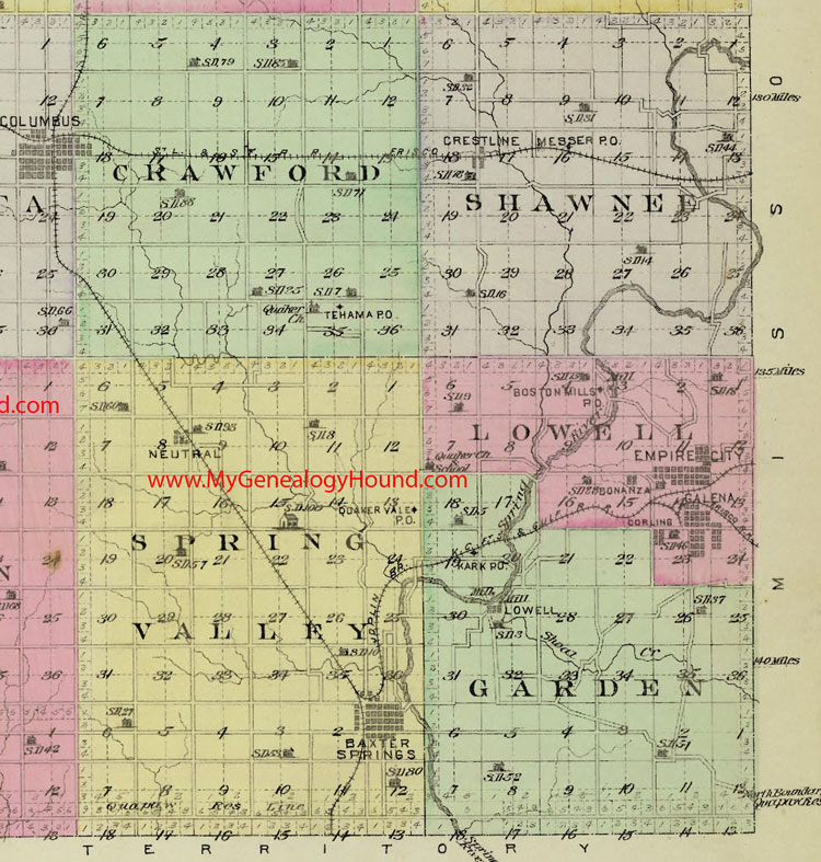
Locations shown include:
Crawford Township: Tehama
Garden Township: Kark, Lowell
Lowell Township: Bonanza, Boston Mills, Empire City, Galena
Shawnee Township: Crestline, Messer
Spring Valley Township: Baxter Springs, Neutral, Quaker Vale
The names shown in all caps are the names of the townships
Buildings shown are school houses, with the school district number (example: SD 52)
This a portion of a map from Official State Atlas of Kansas, by L. H. Everts & Co., 1887
View the complete map of Cherokee County, Kansas here: Cherokee County, Kansas 1887 Map
View family biographies from the 1883 History of Cherokee County: Cherokee County, Kansas
View additional Kansas Maps here: Kansas County Maps
County maps from other states can be viewed here: State County Maps
Additional Cherokee County resources: Cherokee County, Kansas History, Genealogy, and Maps
Use the links at the top right of this page to search or browse thousands of family biographies.