My Genealogy Hound
Dickinson County, Kansas 1887 Map
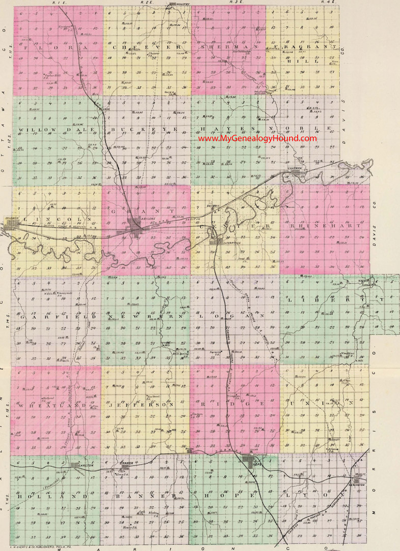
Locations shown include (click on any township name for an enlarged view):
Banner Township:Banner, Elmo, Henry, Rhodes
Buckeye Township
Center Township: Detroit, Enterprise
Cheever Township: Cheever
Flora Township: Keystobne, Poplar Hill
Fragrant Hill Township
Garfield Township: Sunnyside
Grant Township: Abilene
Hayes Township
Holland Township: Carlton
Hope Township: Hope, Wagner Station
Jefferson Township: Dillon (partial), New Basel
Liberty Township: Lyona, Woodbine
Lincoln Township: Solomon (partial)
Logan Township: Navarre
Lyon Township: Herington
Newbern Township: Bell Spring
Noble Township: Chapman
Rhinehart Township
Ridge Township: Dillon (partial), Newbern, Plimpton
Sherman Township: New Chillicothe, Sutphen Mills
Union Township: Aroma
Wheatland Township: Holland
Willow Dale Township
The names shown in all caps are the names of the townships
This a map from Official State Atlas of Kansas, by L. H. Everts & Co., 1887
View additional Kansas Maps here: Kansas County Maps
County maps from other states can be viewed here: State County Maps
Use the links at the top right of this page to search or browse thousands of family biographies.