My Genealogy Hound
Williamson County, Tennessee 1888 Map
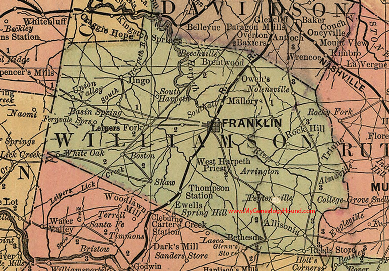
Locations shown include: Allisonia, Arrington, Basin Spring, Beechville, Bethesda, Boston, Brentwood, College Grove, Ewells, Fernvale Springs, Franklin, Jingo, Leipers Fork, Mallorys, Nolensville, Owen's, Peytonsville, Preist, Reeds Store, Rock Hill, Shaw, South Harpeth, Thompson Station, Triune, Union Valley, West Harpeth, White Oak
This a portion of a Tennessee map by Rand, McNally & Co. 1882, 1888
View additional Tennessee Maps here: Tennessee County Maps
County maps from other states can be viewed here: State County Maps
Additional Williamson County resources: Williamson County, Tennessee History and Genealogy
Use the links at the top right of this page to search or browse thousands of family biographies.