My Genealogy Hound
White County, Tennessee 1888 Map
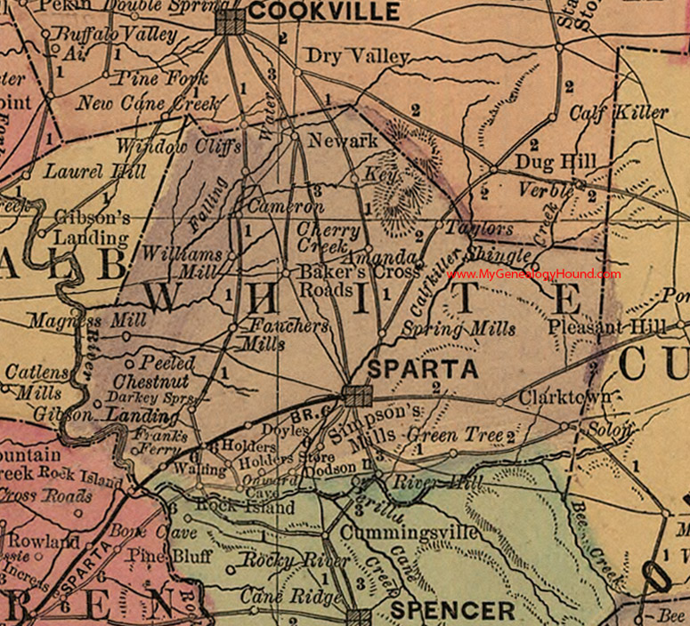
Locations shown include: Amanda, Baker's Cross Roads, Cameron, Cherry Creek, Clarktown, Darkey Springs, Dodson, Doyles, Fauchers Mills, Frank's Ferry, Gibson Landing, Green Tree, Holders, Holders Store, Key, Newark, Onward Cave, Peeled Chestnut, Perilla, River Hill, Rock Island, Shingle, Simpson's Mills, Solon, Sparta, Spring Mills, Taylors, Walling, Williams Mill
This a portion of a Tennessee map by Rand, McNally & Co. 1882, 1888
View additional Tennessee Maps here: Tennessee County Maps
County maps from other states can be viewed here: State County Maps
View biographies from White County, Tennessee here: White County, Tennessee
Additional White County resources: White County, Tennessee History and Genealogy
Use the links at the top right of this page to search or browse thousands of family biographies.