My Genealogy Hound
Sullivan County, Tennessee 1888 Map
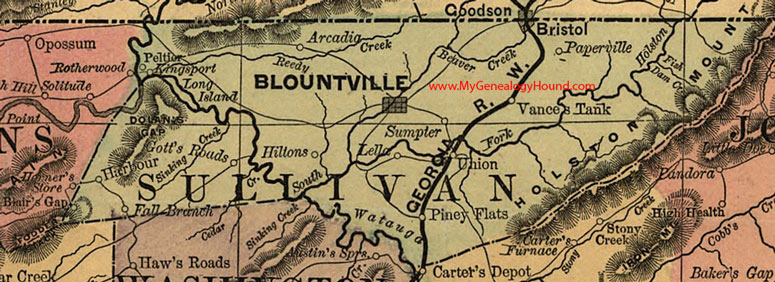
Locations shown include: Arcadia, Blair's Gap, Blountville, Bristol, Fall Branch, Gott's Roads, Harbour, Hiltons, Kingsport, Lella, Paperville, Peltier, Piney Flats, Sumpter, Union, Vance's Tank
This a portion of a Tennessee map by Rand, McNally & Co. 1882, 1888
View additional Tennessee Maps here: Tennessee County Maps
County maps from other states can be viewed here: State County Maps
Additional Sullivan County resources: Sullivan County, Tennessee History and Genealogy
Use the links at the top right of this page to search or browse thousands of family biographies.