My Genealogy Hound
Loudon County, Tennessee 1888 Map
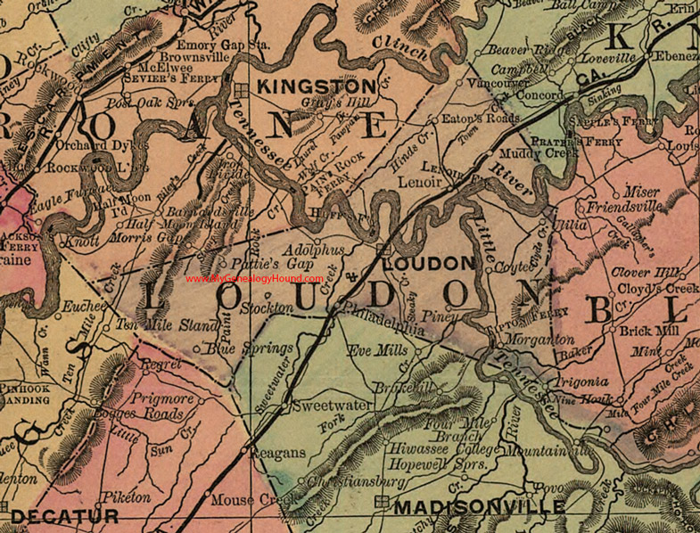
Locations shown include: Adolphus, Blue Springs, Coytee, Eaton's Roads, Huff's Ferry, Lenoir, Loudon, Muddy Creek, Pattie's Gap, Philadelphia, Piney, Stockton, Tipton Ferry, Trigonia, Ulilia, Vancouver
This a portion of a Tennessee map by Rand, McNally & Co. 1882, 1888
View additional Tennessee Maps here: Tennessee County Maps
County maps from other states can be viewed here: State County Maps
Additional Loudon County resources: Loudon County, Tennessee History and Genealogy
Use the links at the top right of this page to search or browse thousands of family biographies.