My Genealogy Hound
Hawkins County, Tennessee 1888 Map
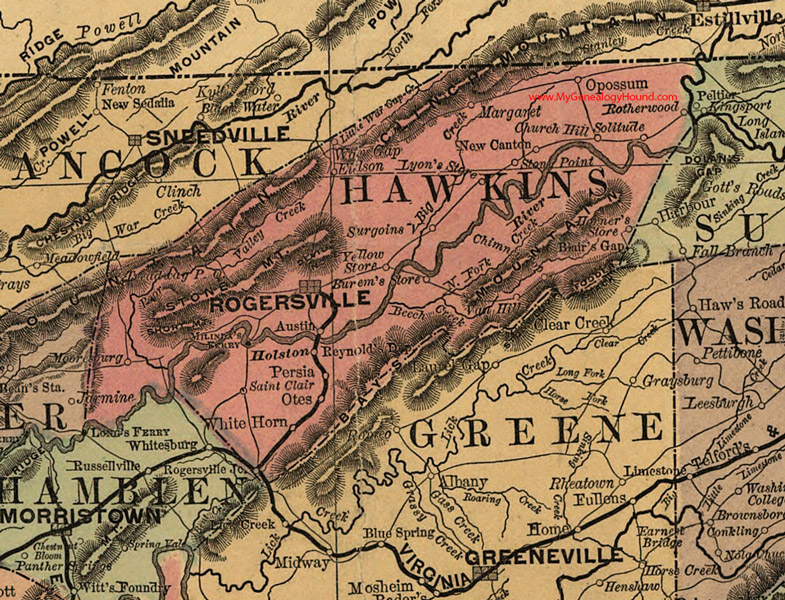
Locations shown include: Austin, Burem's Store, Chimney Top, Church Hill, Eidson, Holston, Horner's Store, Lyon's Store, Margaret, Milinda's Ferry, Mooresburg, New Canton, Oppossum, Otes, Persia, Reynold's Depot, Rogersville, Rogersville Junction, Rotherwood, Saint Clair, Solitude, Stony Point, Surgoinsville, Treadway, Van Hill, War Gap, White Horn, Yellow Store
This a portion of a Tennessee map by Rand, McNally & Co. 1882, 1888
View additional Tennessee Maps here: Tennessee County Maps
County maps from other states can be viewed here: State County Maps
Additional Hawkins County resources: Hawkins County, Tennessee History and Genealogy
Use the links at the top right of this page to search or browse thousands of family biographies.