My Genealogy Hound
Hamilton County and James County, Tennessee 1888 Maps
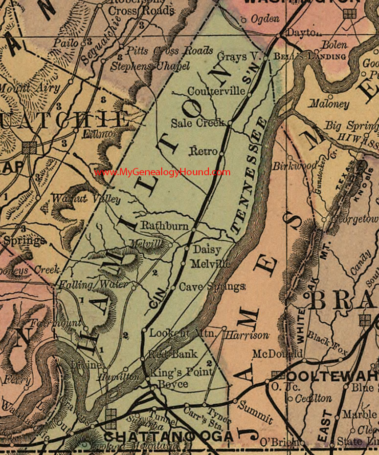
Locations shown include: Boyce, Carr's Station, Cave Springs, Chattanooga, Coulterville, Cravens, Daisy, Divine, Fairmount, Falling Water, Grays V., Hamilton, King's Point, Lookout, Lookout Mountain, Melville, Rathburn, Red Bank, Retro, Sale Creek, Subunba, Tunnel, Tyner, Wauhatchie
Also includes: James County, Tennessee: Birkwood (Birchwood), Harrison, Ooltewah, Ooltewah Junction, Summit
James County existed only from 1871 to 1919. James County was created in 1871 from the eastern portion of Hamilton County and was combined back into Hamilton County in 1919.
This a portion of a Tennessee map by Rand, McNally & Co. 1882, 1888
View additional Tennessee Maps here: Tennessee County Maps
County maps from other states can be viewed here: State County Maps
Additional Hamilton County resources: Hamilton County, Tennessee History, Genealogy and Maps
Use the links at the top right of this page to search or browse thousands of family biographies.