My Genealogy Hound
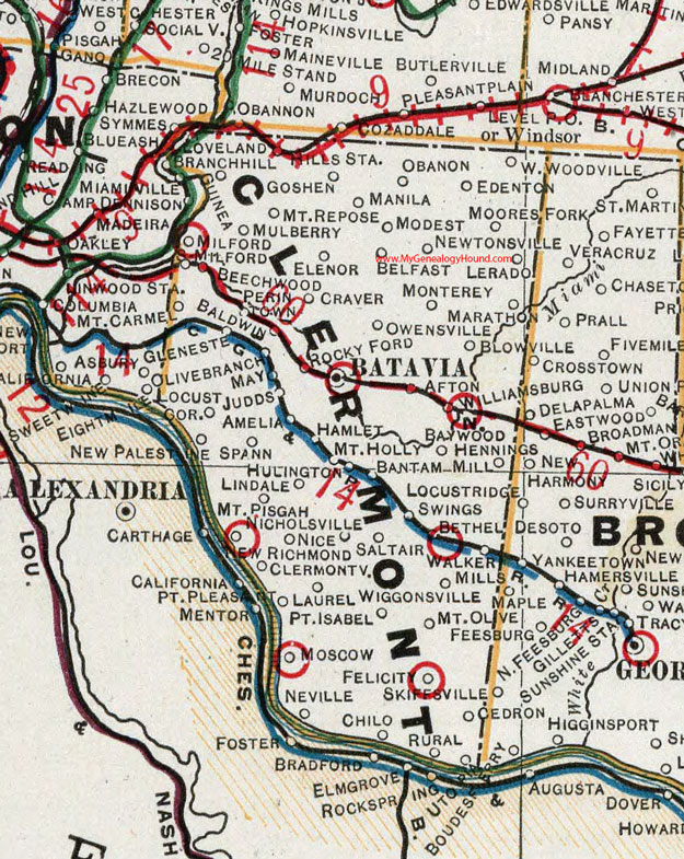
Clermont County, Ohio 1901 Map

Locations shown include: Afton * Amelia * Baldwin * Bantam * Batavia * Baywood * Beechwood * Belfast * Bethel * Blowville * Branch Hill * Cedron * Chilo * Clermontville * Craver * Edenton * Elenor * Felicity * Hamlet * Hennings Mill * Hills Station * Hulington * Glen Este * Goshen * Guinea * Judds * Laurel * Lerado * Lindale * Locust Corner * Loveland * Manila * Marathon * May * Miamiville * Milford * Modest * Moores Fork * Monterey * Moscow * Mount Carmel * Mount Holly * Mount Olive * Mount Pisgah * Mount Repose * Mulberry * Neville * New Palestine * New Richmond * Newtonsville * Nice * Nicholsville * Obanon * Olive Branch * Owensville * Perintown * Point Isabel * Point Pleasant * Rocky Ford * Rural * Saltair * South Milford * Spann * Swings * Utopia * Walker Mills * West Woodville * Wiggonsville * Williamsburg
This Clermont County map is a portion of an 1901 Ohio map by Cram.
View additional Ohio Maps here: Ohio County Maps
County maps from other states can be viewed here: State County Maps
Use the links at the top right of this page to search or browse thousands of family biographies.