My Genealogy Hound
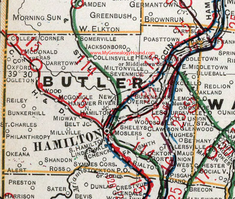
Butler County, Ohio 1901 Map

Locations shown include: Alert * Bethany * Blueball * Bunkerhill * Busenbark * College Corner * Contreras * Darrtown * East Middleton * Excello * Fairsmith * Flockton * Gano * Hamilton * Hamilton Jct. * Hanover * Heno P O * Hughes * Jones * Lawson * Lemon * Le Sourdsville * Lindenwald * Maud * McDonald * McGonigle * Middletown * Middletown Station * Midway Belt Jct. * Millville * Miltonville * Monroe * Monroe Station * Moslers * Oakland * Ogleton * Okeana * Overpeck * Oxford * Philanthropy * Pisgah * Poast Town * Port Union * Reiley * Rialto * Ross * St. Charles * Schenck * Shandon * Sheleys * Somerville * South Hamilton * Stockton P O * Symmes Corners * Trenton * Tylersville * Westchester * Wood * Woodsdale
This Butler County map is a portion of an 1901 Ohio map by Cram.
View additional Ohio Maps here: Ohio County Maps
County maps from other states can be viewed here: State County Maps
Use the links at the top right of this page to search or browse thousands of family biographies.