My Genealogy Hound
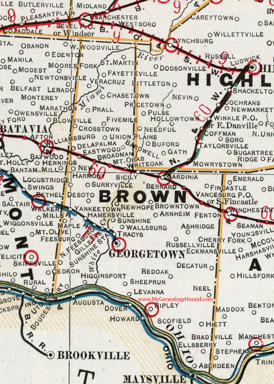
Brown County, Ohio 1901 Map

Locations shown include: Aberdeen * Arnheim * Ashridge * Bardwell * Bernard * Boudes Ferry * Broadman * Browntown * Crosstown * Delapalma * Decatur * Desoto * Eastwood * Ellsberry * Fayetteville * Fincastle * Fivemile * Georgetown * Gilletts * Hamersville * Hiett * Higginsport * Levanna * Locust Ridge * Maple * Mt. Orab * Neel * New Harmony * New Hope * North Feesburg * Prall * Redoak * Ripley * Russellville * St. Martin * Sardinia * Scofield * Sheeprun * Sicily * Skiffsville * South Fincastle * Sunshine * Sunshine Station * Surryville * Tracys * Union * Veracruz * Vanceburg P O * Wallsburg * Whiteoak * Yankeetown
This Brown County map is a portion of an 1901 Ohio map by Cram.
View additional Ohio Maps here: Ohio County Maps
County maps from other states can be viewed here: State County Maps
Additional Brown County resources: Brown County, Ohio History and Genealogy
Use the links at the top right of this page to search or browse thousands of family biographies.