My Genealogy Hound
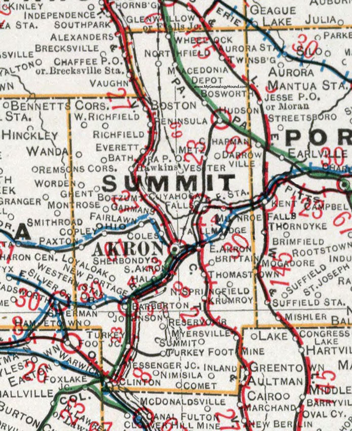
Summit County, Ohio 1901 Map

Locations shown include: Akron * Barberton * Bath * Boston * Bosworth * Botzum * Brittain * Clinton * Coles * Comet * Copley * Cuyahoga Falls * Cuyahoga Falls Station * East Akron * Everett * Fairlawn * Garmans * Ghent * Halo * Hametown * Hawkins * Hudson * Inland * Johnson * Krumroy * Loyal Oak * Macedonia Depot * Messenger Junciton * Metz * Munroe Falls * Myersville * New Portage * Nimisila * Northfield * North Springfield * Paxton * Peninsula * Resevoir * Richfield * Sherbondy * Sherman * Silver Creek * South Akron * Summit * Tallmadge * Thomastown * Turkey Foot Junction * Turkey Foot Mine * Twinsburg * Vester * Wanda * Warwick * Worden * Western Star * West Richfield * Wheelock *
This Summit County map is a portion of an 1901 Ohio map by Cram.
View additional Ohio Maps here: Ohio County Maps
County maps from other states can be viewed here: State County Maps
Use the links at the top right of this page to search or browse thousands of family biographies.