My Genealogy Hound
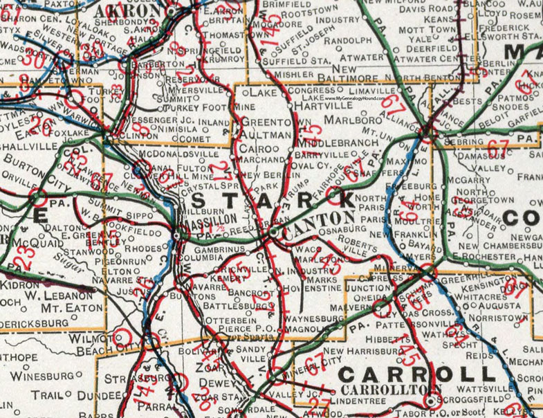
Stark County, Ohio 1901 Map

Locations shown include: Alliance * Aultman * Bancroft * Barryville * Battlesburg * Beach City * Bentley * Cairoo * Canal Fulton * Canton * Clover Hill Mine * Columbia * Congress Lake * Crystal Springs * East Greenville * Elton * Fairhope * Freeburg * Gambrinus * Greentown * Hartville * Hovenstine * Lake * Lake Park * Limaville * Louisville * Justus * Kemery * Magnolia * Mapleton * Marchand * Marks * Marlboro * Massillon * Maximo * McDonaldsville * Middlebranch * Millburn * Minerva * Mount Union * Myers * Navarre * Navarre Station * New Berlin * New Franklin * Newman * North Industry * North Paris * Osnaburg * Oval City * Otterbein * Paris * Pauls * Pierce P O * Pigeon Run * Rhodes * Reedurban * Richville * Robertsville * Shaffers * Sippo * Sparta * Summit * Trump * West Brookfield * Waco * Waynesburg * Wilmot *
This Stark County map is a portion of an 1901 Ohio map by Cram.
View additional Ohio Maps here: Ohio County Maps
County maps from other states can be viewed here: State County Maps
Use the links at the top right of this page to search or browse thousands of family biographies.