My Genealogy Hound
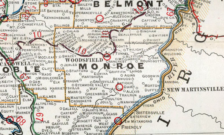
Monroe County, Ohio 1901 Map

Locations shown include: Agins * Aitch * Alexis * Altitude * Antioch * Beallsville * Benwood * Bingham * Brister * Buchanan * Calais * Cameron * Coats * Cranenest * Crosskeys * Dairy * Doherty * Duffy * Dwight * Edwina * Fly * Graysville * Greenbrier * Griffith * Goodwin * Hannibal * Hartshorn * Heralds * Kerr * Jerles * Jerusalem * Jolly * Kuhn P O * Laings * Lewisville * Malaga * Marr * Masterton * Miltonsburg * Monroefield * Morton * Mount Carrick * Oak * Ozark * Poulton * Quarry * Rinard Mills * Round Bottom * Sardis * Sprague * Stafford * Starkey * Switzer * Sycamore Valley * Trail Run * Tunnel * Twilight * Wannamaker * Way * Wise * Wittens * Woodsfield *
This Monroe County map is a portion of an 1901 Ohio map by Cram.
View additional Ohio Maps here: Ohio County Maps
County maps from other states can be viewed here: State County Maps
Use the links at the top right of this page to search or browse thousands of family biographies.