My Genealogy Hound
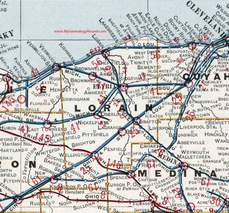
Lorain County, Ohio 1901 Map

Locations shown include: Amherst * Amherst Station * Avon * Avon Lake * Avon Point * Avon Station * Bakers Crossing * Beach Park * Belden * Brighton * Brownhelm * Brownhelm Station * Columbia Station * Copopa * Elyria * Fields P O * Folger P O * Grafton * Henrietta * Huntington * Kipton * Kishmans * Lake Breeze * Lagrange * Laporte * Lorain * Litchfield * Nickel Plate * North Eaton * North Ridgeville * Oberlin * Penfield * Pittsfield * Rugby * Semple * Shawville * Sheffield Station * Trinity * Vermillion * Vermillion Station * Wellington
This Lorain County map is a portion of an 1901 Ohio map by Cram.
View additional Ohio Maps here: Ohio County Maps
County maps from other states can be viewed here: State County Maps
Use the links at the top right of this page to search or browse thousands of family biographies.