My Genealogy Hound
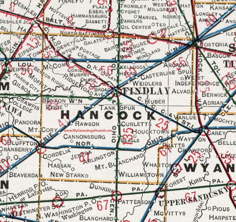
Hancock County, Ohio 1901 Map

Locations shown include: Arcadia * Arlington * Beagle * Benton Ridge * Benton Ridge Station * Broad Ave. * Cannonsburg * Casterline Spur * Chase * Conie * Cordelia * Curletts * Deweyville * Findlay * Hassan * Hatfield * Hecks * Houcktown * Huber * Jenera * Kelloggs * McComb * Mortimer * Mt. Blanchard * Mt. Cory * Murphy * New Stark * Portage Center * Pratts * Rawson * Ridge Road * Shawtown * Tank Spur * Van Buren * Vanlue * Weidlers * West Independence * Williamstown * Wineland
This Hancock County map is a portion of an 1901 Ohio map by Cram.
View additional Ohio Maps here: Ohio County Maps
County maps from other states can be viewed here: State County Maps
Use the links at the top right of this page to search or browse thousands of family biographies.