My Genealogy Hound
Texas County, Missouri 1904 Map
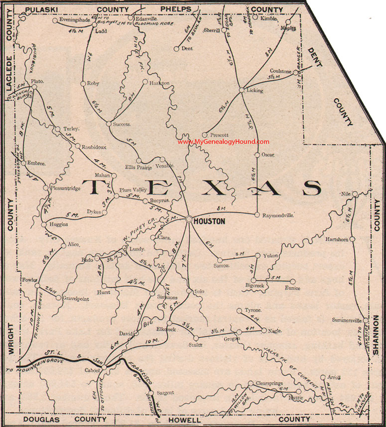
Locations shown include: Alice, Arroll, Bado, Big Creek, Bucyrus, Cabool, Clara, Clear Springs, Coulstone, David, Dent, Dykes, Edanville, Elk Creek, Ellis Prairie, Embree, Eunice, Evening Shade, Fowler, Gravelpoint, Grogan, Hartshorn, Hattie, Hazleton, Houston, Huggins, Hurst, Kimble, Ladd, Licking, Lundy, Mahan, Maples, Nagle, Nile, Oscar, Plato, Pleasant Ridge, Plum Valley, Prescott, Raymondville, Roby, Roubidoux, Samoa, Sargent, Sherrill, Simmons, Solo, Stultz, Success, Summersville, Turley, Tyrone, Venable, Yukon
View family biographies from the 1889 History of Texas County: Texas County, Missouri
View additional Missouri Maps here: Missouri County Maps
County maps from other states can be viewed here: State County Maps
Additional Texas County resources: Texas County, Missouri History, Genealogy, and Maps
Use the links at the top right of this page to search or browse thousands of family biographies.