My Genealogy Hound
Osage County, Missouri 1904 Map
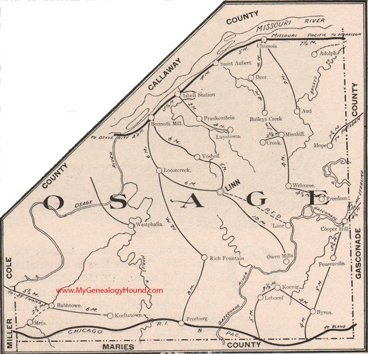
Locations shown include: Adolph, Aud, Babbtown, Baileys Creek, Bonnots Mill, Byron, Chamois, Cooper Hill, Crook, Deer, Freeburg, Freedom, Feuersville, Hope, Isbell Station, Koeltztown, Koenig, Lane, Leboeuf, Linn, Loose Creek, Luystown, Meta, Mint Hill, Owen Mills, Rich Fountain, Saint Aubert, Vosholl, Welcome, Westphalia
View family biographies from the 1889 History of Osage County, Missouri
View additional Missouri Maps here: Missouri County Maps
County maps from other states can be viewed here: State County Maps
Additional Osage County resources: Osage County, Missouri History, Genealogy, and Maps
Use the links at the top right of this page to search or browse thousands of family biographies.