My Genealogy Hound
Boone County, Missouri 1904 Map
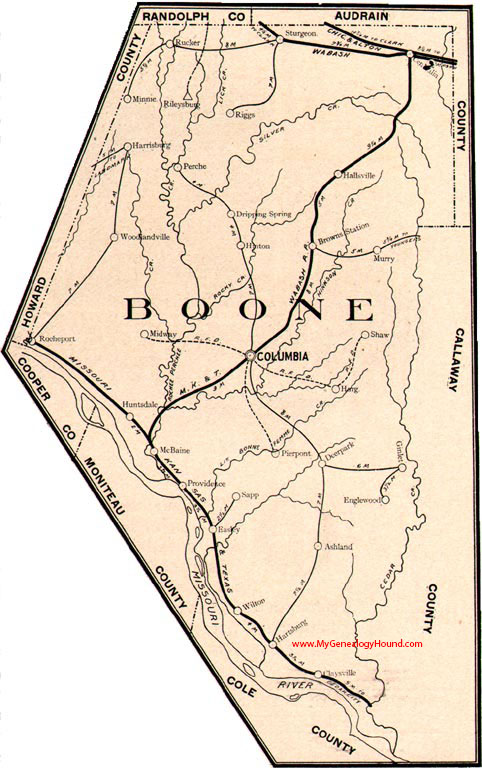
Locations shown include: Ashland, Brown's Station, Claysville, Columbia, Deerpark, Dripping Spring, Easly, Englewood, Ginlet, Hallsville, Harg, Harrisburg, Hartsburg, Hinton, Huntsdale, McBaine, Midway, Minnie, Murray, Perche, Pierpont, Providence, Riggs, Rileysburg, Rocheport, Rucker, Sapp, Shaw, Sturgeon, Wilton, Woodlandville
View additional Missouri Maps here: Missouri County Maps
County maps from other states can be viewed here: State County Maps
Additional Boone County resources: Boone County, Missouri History, Genealogy, and Maps
Use the links at the top right of this page to search or browse thousands of family biographies.