My Genealogy Hound
Christian County, Kentucky 1905 Map
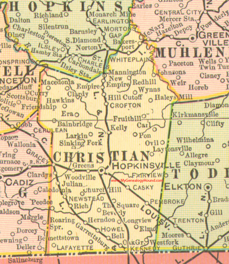
Locations shown include: Bainbridge, Bakersport, Bell, Bennettstown, Beverly, Carl, Casky, Church Hill, Clardy, Clardys, Crofton, Elmo, Empire, Era, Fruit Hill, Garrettsburg, Gracey, Greens, Haleys Mill, Hawkins, Herndon, Hill Cutoff, Hopkinsville, Howel, Johnsons, Julian, Kelly, Kennedy, Lafayette, Larkin, Laytonsville, Longview, Macedonia, Mannington, New Empire, Newstead, Ovil, Pembroke, Pon, Red Hill, Rich, Sinking Fork, The Square, West Fork, White Plains, Woodville, Wynns
This a portion of a Kentucky map from Cram's Ideal Reference Atlas, 1905
View additional Kentucky Maps here: Kentucky County Maps
County maps from other states can be viewed here: State County Maps
Additional Christian County resources: Christian County, Kentucky History and Genealogy
Use the links at the top right of this page to search or browse thousands of family biographies.