My Genealogy Hound
Jefferson County, Kansas 1887 Map
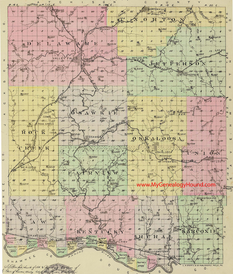
Locations shown include (click on any township name for an enlarged view):
Delaware Township: Valley Falls
Fairview Township: Jacksonville
Jefferson Township: Boyles Station, Lee Station, Winchester
Kaw Township: Grantville
Kentucky Township: Medina Station, Newman, Perry, Thompsonville
Norton Township: Nortonville
Osawkie Township: Osawkie
Oskaloosa Township: McIntosh Station, Oskaloosa
Rock Creek Township: Meriden, Rock Creek
Rural Township: Buck Creek Station, Williamstown
Sarcoxie Township: Chester, Woodstock
Union Township: McLouth
The names shown in all caps are the names of the townships
This a map from Official State Atlas of Kansas, by L. H. Everts & Co., 1887
View additional Kansas Maps here: Kansas County Maps
County maps from other states can be viewed here: State County Maps
Additional Jefferson County Resources: Jefferson County, Kansas History, Genealogy, and Maps
Use the links at the top right of this page to search or browse thousands of family biographies.