My Genealogy Hound
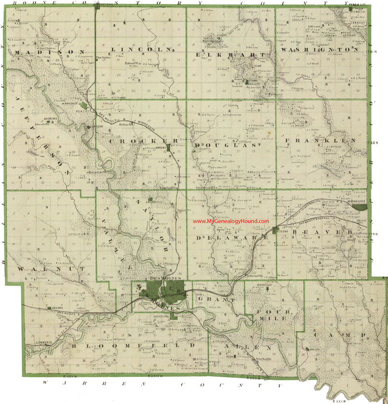
Polk County, Iowa 1875 Map
(Links for enlarged views of Polk County, Iowa township maps are below this map)

Locations shown include (click on any township name for an enlarged view):
Allen Township: Avon, Avon Station
Beaver Township: Altoona (partial), Mitchellville
Bloomfield Township: Sevastopol
Camp Township: Adelphi
Crocker Township: Ankeny, Pelton Station, Trent Station
Delaware Township: Altoona (partial), Oakwood Station
Des Moines Township: Des Moines
Douglas Township: Greenwood
Elkhart Township: Elkhart, Ottawa, White Oak Grove
Four Mile Township: Rising Sun
Franklin Township: Trullingers Grove
Grant Township
Jefferson Township: Andrews, Lincoln, Ridgedale
Lee Township: Des Moines
Lincoln Township: Palmer, Sheldahl (partial), Ulm Station
Madison Township: Corydon, Polk City, Wahkonsa
Saylor Township: Saylor Station, Saylorville
Valley Township
Walnut Township: Ashawa, Commerce
Washington Township: Peoria City
The names shown in all caps are the names of the townships
This is a map published in 1875 within The A. T. Andreas Illustrated Historical Atlas of Iowa, published by Andreas Atlas Co.
View additional Iowa Maps here: Iowa County Maps
County maps from other states can be viewed here: State County Maps
Use the links at the top right of this page to search or browse thousands of family biographies.