My Genealogy Hound
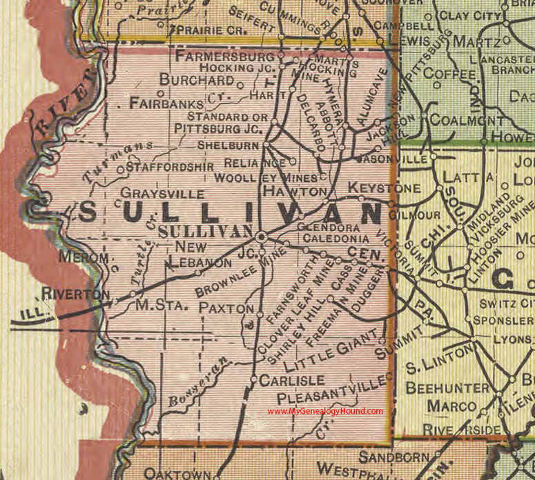
Sullivan County, Indiana 1908 Map

Locations shown include: Alum Cave, Brownlee Mine, Burchard, Caledonia, Carlisle, Cass, Clover Leaf Mine, Delcarbo, Dugger, Abbott, Fairbanks, Farmersburg, Farnsworth, Freeman Mine, Gilmour, Glendora, Graysville, Hart, Hawton, Hocking Mine, Hocking Jc., Hymera, Jackson Hill, Keystone, Marts, Merom, New Lebanon, Little Giant, Paxton, Pittsburg Jc., Pleasantville, Reliance, Riverton, Shelburn, Shirley Hill, Staffordshir, Standard, Sullivan, Woolley Mines
This a portion of a map by Geo. A. Ogle & Co., 1908
View additional Indiana Maps: Indiana County Maps
County maps from other states can be viewed here: State County Maps
Use the links at the top right of this page to search or browse thousands of family biographies.