My Genealogy Hound
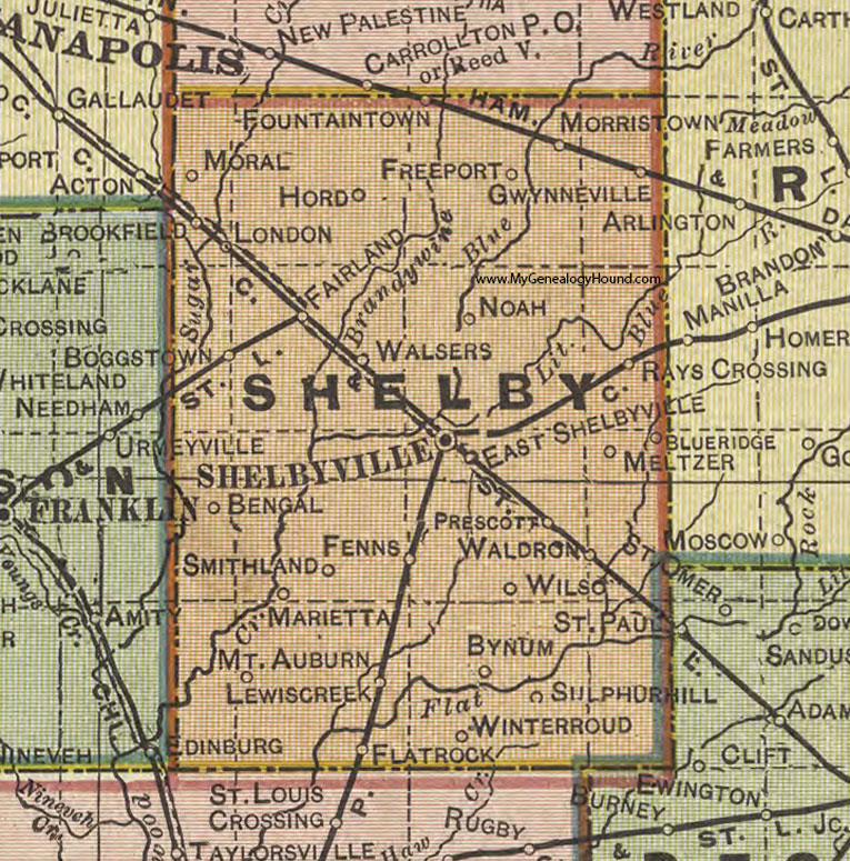
Shelby County, Indiana 1908 Map

Locations shown include: Bengal, Blueridge, Boggstown, Brookfield, Bynum, East Shelbyville, Fairland, Fenns, Flatrock, Fountaintown, Freeport, Gwynneville, Hord, Lewiscreek, London, Marietta, Meltzer, Moral, Morristown, Mt. Auburn, Noah, Prescott, Rays Crossing, Shelbyville, Smithland, Sulphurhill, Waldron, Walsers, Wilso, Winterroud
This a portion of a map by Geo. A. Ogle & Co., 1908
View additional Indiana Maps: Indiana County Maps
County maps from other states can be viewed here: State County Maps
Use the links at the top right of this page to search or browse thousands of family biographies.