My Genealogy Hound
White County, Arkansas 1889 Map
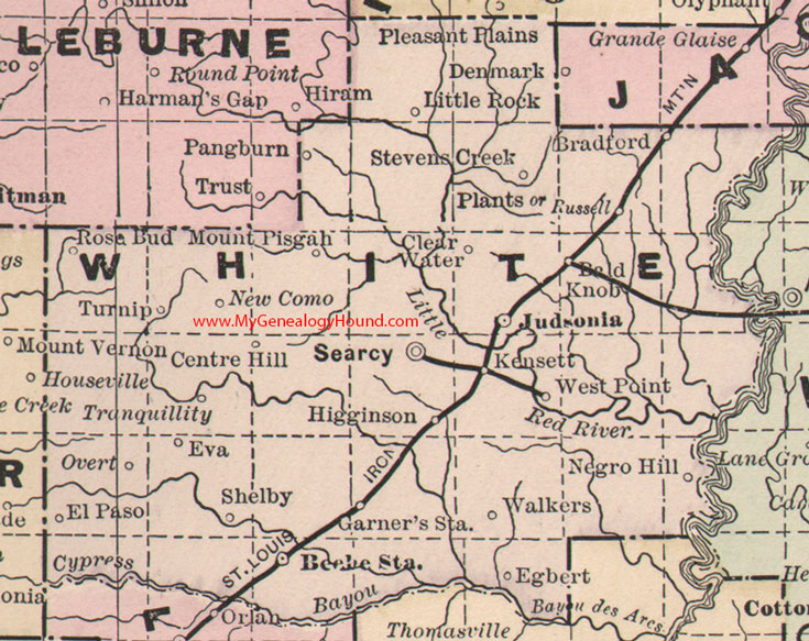
Locations shown include: Bald Knob, Beebe Station, Bradford, Centre Hill, Clear Water, Egbert, El Paso, Eva, Garner's Station, Higginson, Judsonia, Kensett, Little Rock, Mount Pisgah, Negro Hill, New Como, Overt, Pangburn, Plants, Rose Bud, Russell, Searcy, Shelby, Stevens Creek, Tranquility, Turnip, Walkers, West Point
This is a portion of a Arkansas map published by Bradley, circa 1889.
View additional Arkansas Maps here: Arkansas County Maps
County maps from other states can be viewed here: State County Maps
Additional White County resources: White County, Arkansas History, Genealogy, and Maps
Use the links at the top right of this page to search or browse thousands of family biographies.