My Genealogy Hound
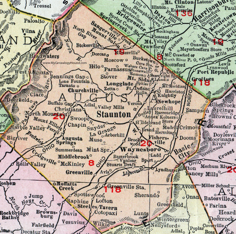
Augusta County, Virginia 1911 Map

Locations shown include: Adlai * Annex * Arborhill (Arbor Hill) * Augusta Springs * Avis * Barrenridge (Barren Ridge) * Barterbrook * Basic City * Bigriver (Big River) * Bodley * Brand * Brookewood * Buffalo Gap * Burketown * Cathay * Cave Station * Christians * Churchville * Clare * Cotopaxi * Craigsville * Crimora * Deerfield * Dooms * Dorcas * Ferrol * Fishersville * Fordwick * Fort Defiance * Greenville * Harriston * Hermitage * Hildebrand * Hilo * Jennings Gap * Knightly * Koiners Store * Ladd * La Grange * Landis * Laurelhill (Laurel Hill) * Lipscomb * Lone Fountain * Longglade (Long Glade) * Lunts * Lyndhurst * Madrid * Marble Valley * McKinley * Middlebrook * Milnesville * Mint Spring * Moffatts Creek * Moscow * Mossy Creek * Mount Elliott * Mount Meridian * Mount Sidney * Mount Solon * Muse * Newhope (New Hope) * North Mountain * North River Gap * Parnassus * Rolla * Roman * Sampson * Sangerville *Seawright Spring * Sherando * Snyder * Spitler * Sport * Spottswood * Staunton * Steeles Tavern * Stokesville * Stonewall * Stover * Stuarts Draft * Summerdean * Swoope * Taranto * Valley Mills * Vanlear * Verona * Waynesboro * West Augusta * Wevers Cave P O * Zetta *
This Augusta County map is a portion of a 1911 Virginia map by Rand McNally.
View additional Virginia Maps here: Virginia County Maps
County maps from other states can be viewed here: State County Maps
Use the links at the top right of this page to search or browse thousands of family biographies.