My Genealogy Hound
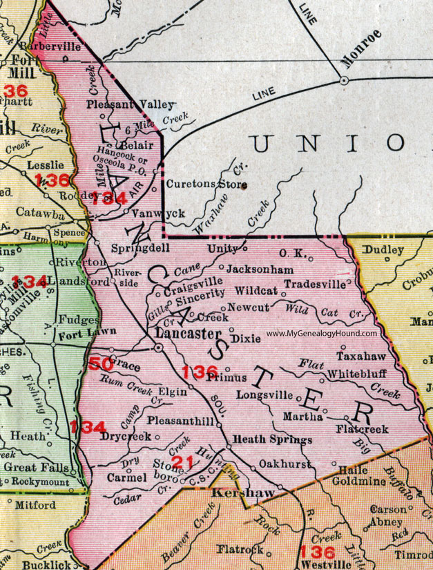
Lancaster County, South Carolina, 1911 Map

Locations shown include: Barberville, Belair, Carmel, Craigsville, Creek, Curetons Store, Dixie, Drycreek, Elgin, Flatcreek, Grace, Haile Goldmine (Haile Gold Mine), Hancock, Heath Springs, Jacksonham, Kershaw, Lancaster, Longsville, Martha, Newcut, O. K., Oakhurst, Osceola P O, Pleasanthill (Pleasant Hill), Pleasant Valley, Primus, Riverside, Roddey, Sincerity, Springdell, Stoneboro, Taxahaw, Tradesville, Unity, Vanwyck, Whitebluff (White Bluff), Wildcat.
This Lancaster County map is a portion of a 1911 South Carolina map by Rand McNally.
View additional South Carolina Maps here: South Carolina County Maps
County maps from other states can be viewed here: State County Maps
Use the links at the top right of this page to search or browse thousands of family biographies, historic photos and vintage postcards.