My Genealogy Hound
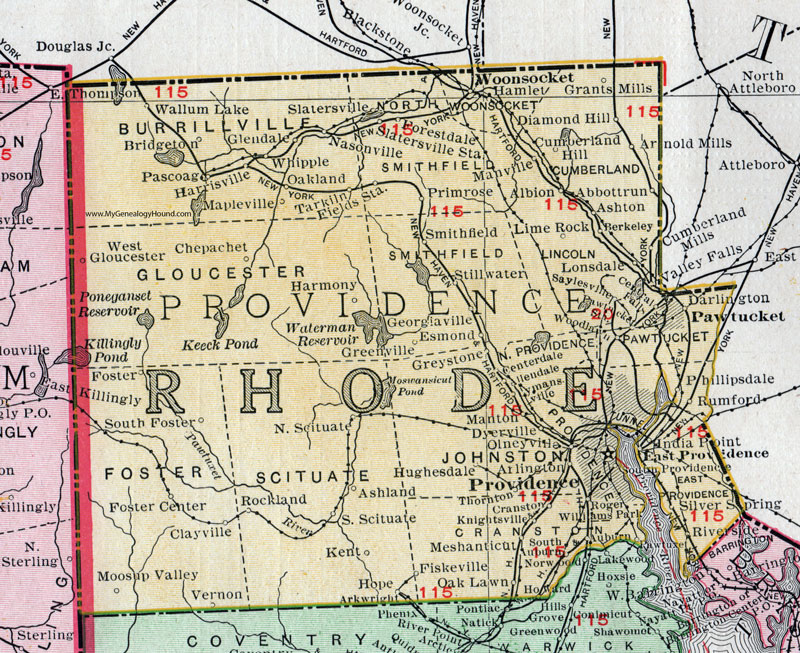
Providence County, Rhode Island, 1911 Map

Locations shown include: Abbottrun (Abbott Run), Albion, Allendale, Arlington, Arnold Mills, Ashland, Ashton, Auburn, Berkeley, Bridgeton, Centerdale, Central Falls, Chepachet, Clayville, Cranston, Cumberland Hill, Cumberland Mills, Darlington, Diamond Hill, Dyervlle, East Providence, Esmond, Fields Station, Fiskeville, Forestdale, Foster, Foster Center, Georgiaville, Glendale, Grants Mill, Greenville, Hamlet, Harmony, Harrisville, Hope, Howard, Hughesdale, India Point, Kent, Knightsville, Lime Rock, Lonsdale, Lymansville, Manton, Manville, Mapleville, Meshanticut, Moosup Valley, Nasonville, North Providence, North Scituate, Oakland, Oak Lawn, Olneyville, Pascoag, Pawtucket, Phillipsdale, Primrose, Providence, Riverside, Rockland, Roger Williams Park, Rumford, Saylesville, Silver Spring, Slatersville, Slatersville Station, Smithfield, South Auburn, South Foster, South Providence, South Scituate, Stillwater, Tarkiln, Thornton, Valley Falls, Vernon, Wallum Lake, West Gloucester, Whipple, Woodlawn, Woonsocket.
This Providence County map is a portion of a 1911 Rhode Island map by Rand McNally.
View additional Rhode Island Maps here: Rhode Island County Maps
County maps from other states can be viewed here: State County Maps
Use the links at the top right of this page to search or browse thousands of family biographies.