My Genealogy Hound
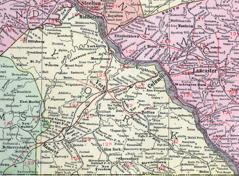
York County, Pennsylvania 1911 Map

Locations shown include: Admire * Ailston * Airville * Alpine * Andersontown * Arbor * Bair * Baldeagle (Bald Eagle) * Bandana * Benroy * Bigdam * Bigmount (Big Mount) * Bittersville * Black Rock * Bonnair * Boyle * Bridgeton * Brillhart * Brodbecks * Brogueville * Brownton * Bruce * Bryansville * Campbell * Castle Fin * Castle Fin Station * Chanceford * Clearspring (Clear Spring) * Codorus * Cold Spring * Cly P O * Constitution * Crossroads * Craley * D. & M. Junction * Dallastown * Dallastown Junction * Davidsburg * Delroy * Delta * Dillsburg * Dolf * Dover * Draco * Eastmont * East Prospect * Emigsville * Enterprise * Etters P O * Falls * Farmers * Felton * Fenmore * Fiscal * Fortney * Franklintown * Freysville * Gatchellville * Gemmill * Girard * Gitts Run * Glatfelters * Glen Rock * Glenville * Golden * Goldsboro * Goram * Grahamville * Grantley * Graybill * Graydon * Hall * Hallam * Hametown * Hanover * Hanover Junction * Heller * Hiestand * High Rock * Hobart * Hokes P O * Holtz * Hopewell Center * Intersection * Ironore P O * Iron Ridge * Jacobs Mills * Jacobus * Keys * Kisinger * Kyleville * Labott * Larue * Laurel * Lewisberry * Loganville * Longlevel * Lucky * Manchester * Marburg * Marsh Run * Martin * McCall Ferry * McDermott * Menges * Menges Mills * Middletown Ferry * Monaghan * Mount Royal * Mount Top * Mount Wolf * Muddy Creek Forks * Mulberry * Naces * Nashville * Neiman * Newberrytown * New Bridgeville * New Freedom * New Park * New Salem * Okete * Ore Valley * Orwig * Paper Mill * Parke P O * Peach Bottom * Pentland * Plankroad * Porters * Porters Sideling P O * Potosi * Railroad P O * Redlion (Red Lion) * Relay * Rinely * Rockey * Roler * Rossville * Rye * Saginaw * Seitzland * Seven Valleys P O * Sheffer * Shrewsbury * Shrewsbury P O * Siddonsburg * Sinsheim * Slab * Slatehill (Slate Hill) * Smiths Station * Smyser * South Side * Spring Forge P O * Springet * Spring Grove * Springvale * Spry * Staley * Starview * Stewartstown * Stiltz * Strickhousers * Strickler * Strinestown * Stoner * Stonybrook * Summit * Sunnyburn * Swam * Taxville * Thomasville * Tilden * Tolna P O * Turnpike * Valley Junction * Weigelstown * Wellsville * West Bangor * West York * Wilben * Windsor * Winterstown * Wiota * Woodbine * Wrightsville * Yocumtown * Yoe * York * Yorkana * Yorkhaven (York Haven) * Ziegler * Zions View *
This York County map is a portion of an 1911 Pennsylvania map by Rand McNally. See the enlarged map views below.

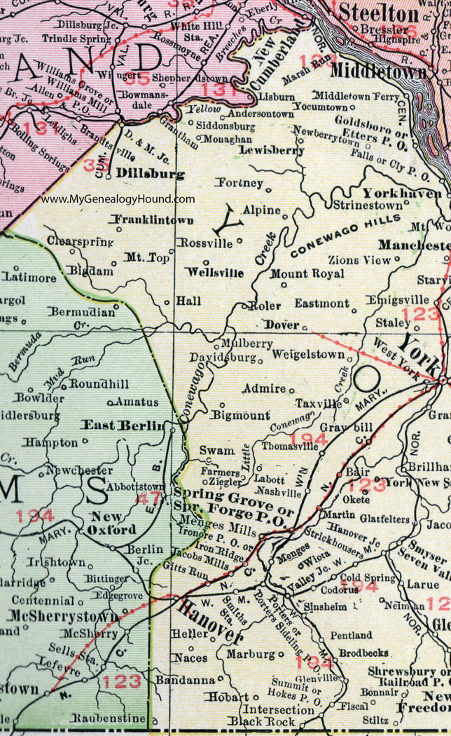
An enlarged view of western York County, Pennsylvania on an 1911 map by Rand McNally.

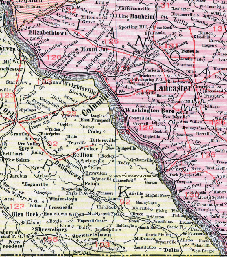
An enlarged view of eastern York County, Pennsylvania on an 1911 map by Rand McNally.
View additional Pennsylvania Maps here: Pennsylvania County Maps
County maps from other states can be viewed here: State County Maps
Use the links at the top right of this page to search or browse thousands of family biographies.