My Genealogy Hound
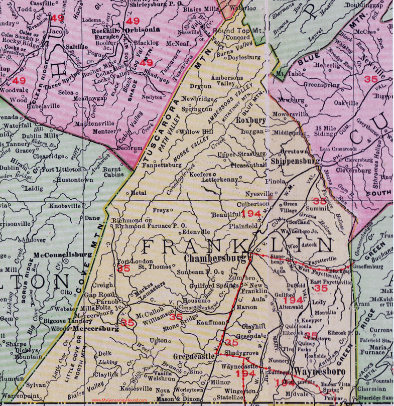
Franklin County, Pennsylvania 1911 Map

Locations shown include: Altenwald * Ambersons Valley * Aqua * Aula * Beautiful * Bino * Blackgap (Black's Gap) * Buena Vista Spring * Chambersburg * Clayhill (Clay Hill) * Claylick * Concord * Creigh * Culbertson * Delk * Doylesburg * Dryrun (Dry Run) * Duffield * East Fayetteville * Edenville * Elbrook * Elbrook P O * Fannettsburg * Fayetteville * Five Forks * Foltz * Fort Loudon * Freys * Housum * Gap Road * Greencastle * Greendale * Green Village *Guilford * Guilford Springs * Kasiesville * Kauffman * Keefers * Knepper * Ledy * Lemasters * Letterkenny * Lurgan * Marion * Markes * Mason and Dixon * McCulloh * Mercersburg * Mercersburg Junction * Metal * Midvale * Milnor * Montalto (Mont Alto) * Mowersville * Newbridge * New Franklin * Nova * Nunnery * Nyesville * Orrstown * Parnob * Penmar (Pen Mar) * Pinola * Plainfield * Pleasanthall (Pleasant Hall) * Quincy * Quinsonia * Richmond * Richmond Furnace P O * Roadside * Rouzerville * Roxbury * Saint Thomas * Scotland * Shadygrove (Shady Grove) * Springrun (Spring Run) * Stateline (State Line) * Stone Bridge * Stonehenge * Summit * Sunbeam P O * Sylvan * Tomstown * Upper Strasburg * Upton * Vanilla * Warrenpoint (Warren Point) * Waynecastle * Waynesboro * Welshrun (Welsh Run) * West Fayetteville * Williamson * Willow Hill * Wingerton * Woods * Woodstock * Worleytown * Zullinger * Zumbro *
This Franklin County map is a portion of an 1911 Pennsylvania map by Rand McNally.
View additional Pennsylvania Maps here: Pennsylvania County Maps
County maps from other states can be viewed here: State County Maps
Use the links at the top right of this page to search or browse thousands of family biographies.