My Genealogy Hound
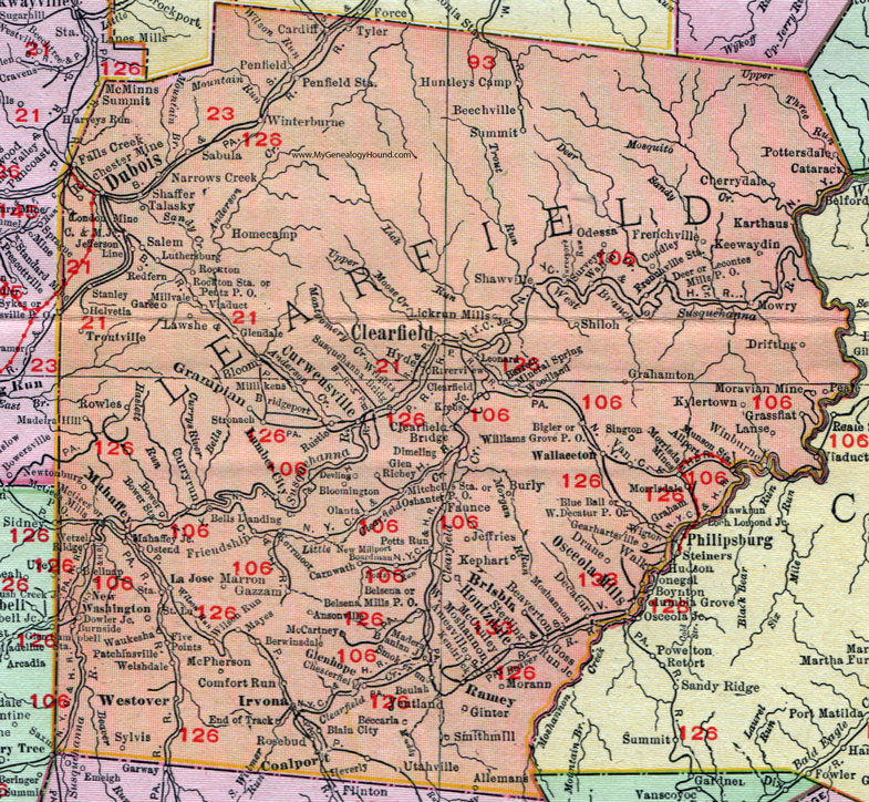
Clearfield County, Pennsylvania 1911 Map

Locations shown include: Allemans * Allport * Amesville * Ansonville * Banian Junction * Barrett * Beaverton * Beccaria * Beechville * Bellknap * Bells Landing * Belsena * Belsena Mills P O * Berwinsdale * Beulah * Bigler * Blain City * Bloom * Bloomington * Blue Ball * Boardman * Bower * Bower Station * Bridgeport * Brisbin * Burly * Burnside * C and M Junction * Cardiff * Carnwath * Cataract * Cherrydale * Chesterfield * Clearfield * Clearfield Bridge * Clearfield Junction * Coalport * Columbia Grove * Comfort Run * Coudley * Curryrun (Curry Run) * Curwensville * Decatur * Deer * Devling * Dimeling * Donegal * Dowler Junction * Drane * Drifting * Dubois * End of Track * Falls Creek * Faunce * Five Points * Frenchville * Frenchville Station * Friendship * Garee * Gazzam * Gearhartsville * Ginter * Glendale * Glenhope (Glen Hope) * Glen Richey * Goss Run Junction * Graham * Grahamton * Grampian * Grassflat * Hawkrun (Hawk Run) * Helvetia * Heverly * Homecamp (Home Camp) * Houtzdale * Hudson * Huntleys Camp * Hyde * Irvona * Jefferson Line * Jeffries * Karthaus * Keewaydin * Kendrick * Kephart * Kerrmoor * Krebs * Kylertown * La Jose * Lanse * Lawshe * Lecontes Mills P O * Leonard * Lickrun Mills (Lick Run Mills) * Loch Lomond Junction * Luthersburg * Madera * Madiera Hill * Mahaffey * Mahaffey Junction * Marron * Mayes * McCauley * McGees * McGees Mills P O * McPherson * Millikens * Millvale * Mineral Spring * Mitchells Station * Morann * Moravian Mine * Morrisdale * Morrisdale Mines * Moshannon * Mowry * Munson Station * N.Y.C. Junction * Narrows Creek * New Millport * Newtonburg * New Washington * Odessa * Olanta * Osceola Mills * Oshanter P O * Ostend * Patchinsville * Peale * Penfield * Penfield Station * Pentz P O * Pottersdale * Potts Run * Ramey * Redfern * Ridge * Riverview * Rochester Mine * Rocton * Rockton Station * Rosebud * Rowles * Rustic * Sabula * Saint Lu * Salem * Shaffer * Shawville * Shiloh * Sington * Smithmill (Smith Mills) * Smokerun (Smoke Run) * Stanley * Sterling * Stronach * Summit * Surveyor * Susquehanna Bridge * Sylvis * Talasky * Troutville * Tyler * Utahville * Van * Ventland * Viaduct * Walk * Wallaceton * Walton * Waukesha * Welshdale * West Decatur P O * West Moshannon * Westover * Wetzel * Wigton * Williams Grove P O * Wilson Run * Winburne * Winterburne * Woodland * Wrights *
This Clearfield County map is a portion of an 1911 Pennsylvania map by Rand McNally. See the enlarged map views below.

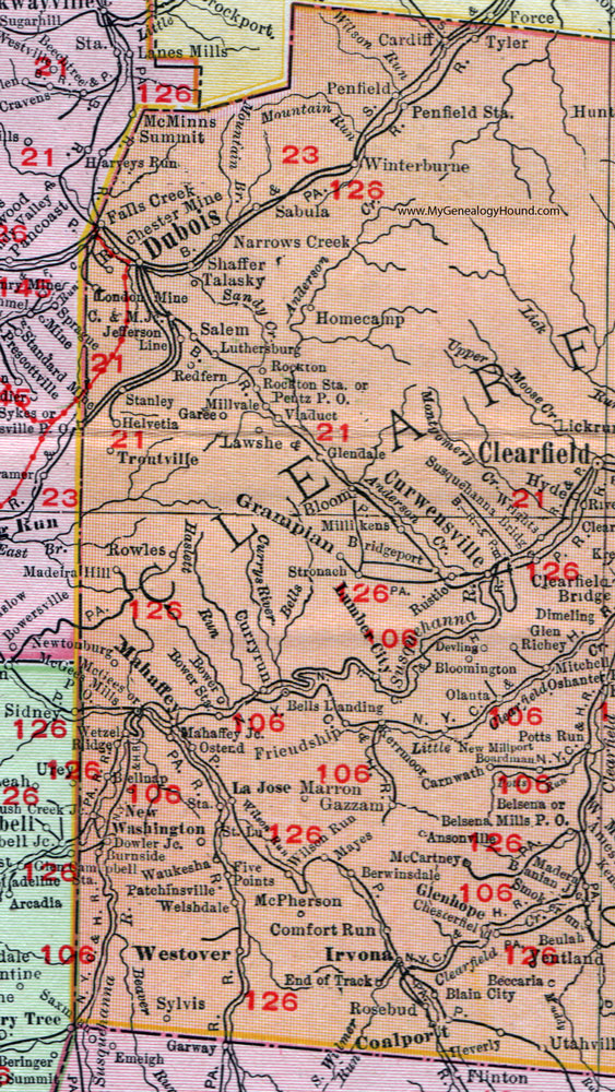
An enlarged view of western Clearfield County, Pennsylvania on an 1911 map by Rand McNally.

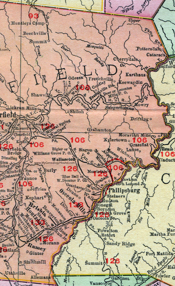
An enlarged view of eastern Clearfield County, Pennsylvania on an 1911 map by Rand McNally.
View additional Pennsylvania Maps here: Pennsylvania County Maps
County maps from other states can be viewed here: State County Maps
Use the links at the top right of this page to search or browse thousands of family biographies.