My Genealogy Hound
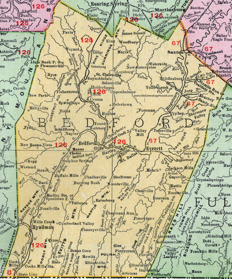
Bedford County, Pennsylvania 1911 Map

Locations shown include: Alum Bank P O * Artemas * Ashcom * Bakers Summit * Bard * Beans Cove * Bedford * Bedford Springs * Breezewood * Brumbaugh * Buffalo Mills * Burning Bush * Cessna * Chalybeate * Chaneysville * Chapman Run * Charlesville * Clearville * Cliffs * Coaldale Station * Cooks Mills * Cooks Mills Station * Cruse * Cumberland Valley * Cypher * Defiance * Dunnnings Creek Junction * Edgehill * Elbinsville * Emerson * Emmaville * Everett * Evitts * Fishertown * Foreman * Fossilville * Fyan * Gapsville * Glee * Graceville * Hale * Hartley * Helixville * Hewitt * Hoblitzel * Holderbaum * Hopewell * Hughes * Hyndman * Imler * Imlertown * Inglesmith * Jackson Mills * Kearney * Kegg * King * Koontzville * Langdondale * Loysburg * Lutzville * Madley Station * Manns Choice * Maria * Mattie * Mench * Mount Dallas * Napier * New Buena Vista * New Enterprise * New Paris * Oppenheimer * Osterburg * Patience * Pavia * Pineridge * Pineycreek * Pleasantville * Point * Purcell * Queen * Rainsburg * Rays Hill * Reynoldsdale * Riddlesburg * Robinsonville * Ryot * Saint Clairsville * Salemville * Sandy Run * Saxton * Schellsburg * Sills * Silvermills (Silver Mills) * Sixmile Run * Speelman P O * Springhope * Springmeadow (Spring Meadow) * State Line * Steckman * Straub * Sulphur Springs * Tatesville * Valley Mill * Waterside * Westend * Weyant * Wills Creek * Wolfsburg * Woodbury * Yellowcreek (Yellow Creek) * Younts *
This Bedford County map is a portion of an 1911 Pennsylvania map by Rand McNally.
View additional Pennsylvania Maps here: Pennsylvania County Maps
County maps from other states can be viewed here: State County Maps
Use the links at the top right of this page to search or browse thousands of family biographies.