My Genealogy Hound
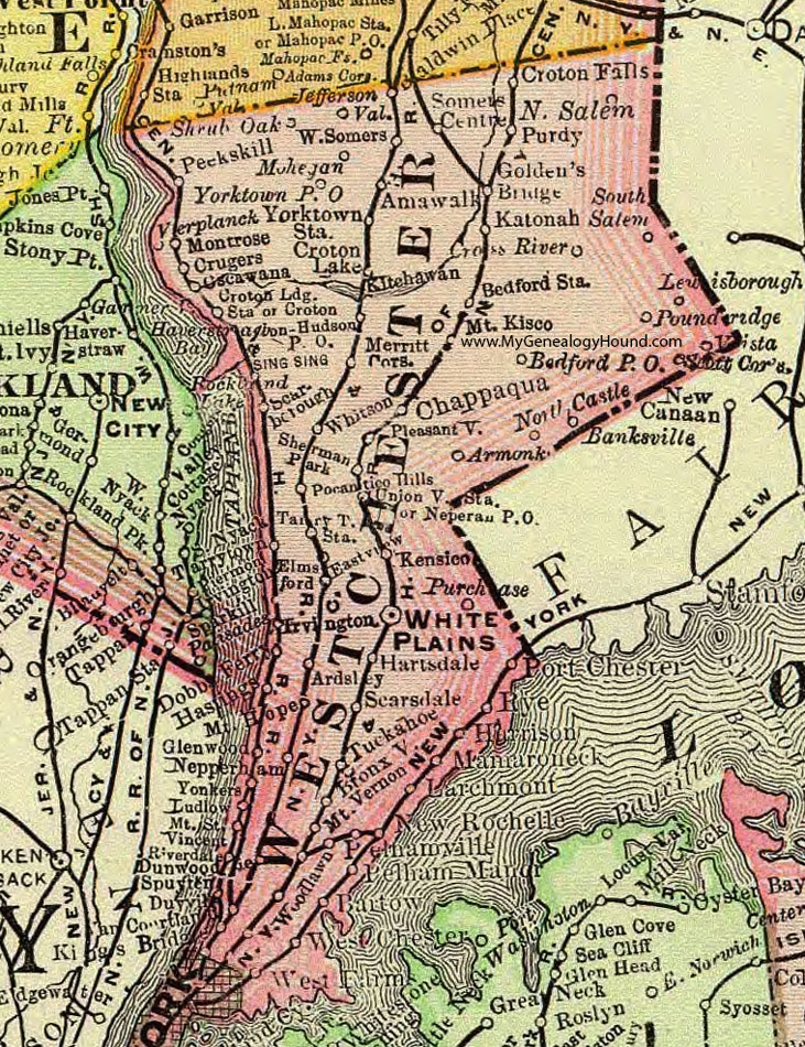
Westchester County, New York 1897 Map

Locations shown include: Amawalk * Ardsley * Armonk * Banksville * Bartow * Bedford P O * Bedford Station * Bronxville * Chappaqua * Cross River * Croton Falls * Croton Lake * Croton Lodge Station * Croton-On-Hudson * Crugers * Dobbs Ferry * Dunwoodie * Eastview * Elmsford * Glenwood * Golden's Bridge * Harrison * Hartsdale * Hastings * Irvington * Jefferson Valley * Katonah * Kenisco * Kings Bridge * Kitchawan * Larchmont * Lewisborough * Ludlow * Mamaroneck * Merritt Corners * Mohegan * Montrose * Mount Hope * Mount Kisco * Mount St. Vincent * Mount Vernon * Nepperhan * Nepperhan P O * New Rochelle * North Castle * North Salem * Oscawana * Peekskill * Pelham Manor * Pelhamville * Pleasantville * Pocantico Hills * Port Chester * Pound Ridge * Purchase * Purdy * Riverdale * Rye * Scarborough * Scarsdale * Scotts Corners * Sherman Park * Shrub Oak * Somers Center * South Salem * Spuyten Duyvil * Tarrytown * Tarrytown Station * Tuckahoe * Unionville Station * Van Cortlandt * Verplanck * Vista * West Chester * West Farm * West Somers * White Plains * Whitson * Woodlawn * Yonkers * Yorktown P O * Yorktown Station *
This Westchester County map is a portion of an 1897 New York map by Rand McNally.
View additional New York Maps here: New York County Maps
County maps from other states can be viewed here: State County Maps
Use the links at the top right of this page to search or browse thousands of family biographies.