My Genealogy Hound
New York County, New York 1895 Map

Locations shown include: Bedford Park * Belmont * Bronx * Casanova * Central Morrisania * Fordham * Fordham Heights * Fort George * Fort Washington * High Bridge * Hudson Park * Hunt Point * Inwood * Jerome Park * Kings Bridge * Manhattan * Manhattanville * Melrose * Morris Dock * Morrisania * Mosholu * Mott Haven * Mount Eden * Mount Hope * Mt. St. Vincent * Oak Point * Oloff Park * Port Morris * Riverdale * Spuyten Duyvil * Tremont * Van Courtlandt * West Farms * Woodlawn * Woodstock *
This New York County map is from an 1895 New York Atlas by Julius Bien.
In 1914, the northern and northeastern portion of New York County was separated off to create Bronx County (Bronx Borough). See the enlarged map portions below.
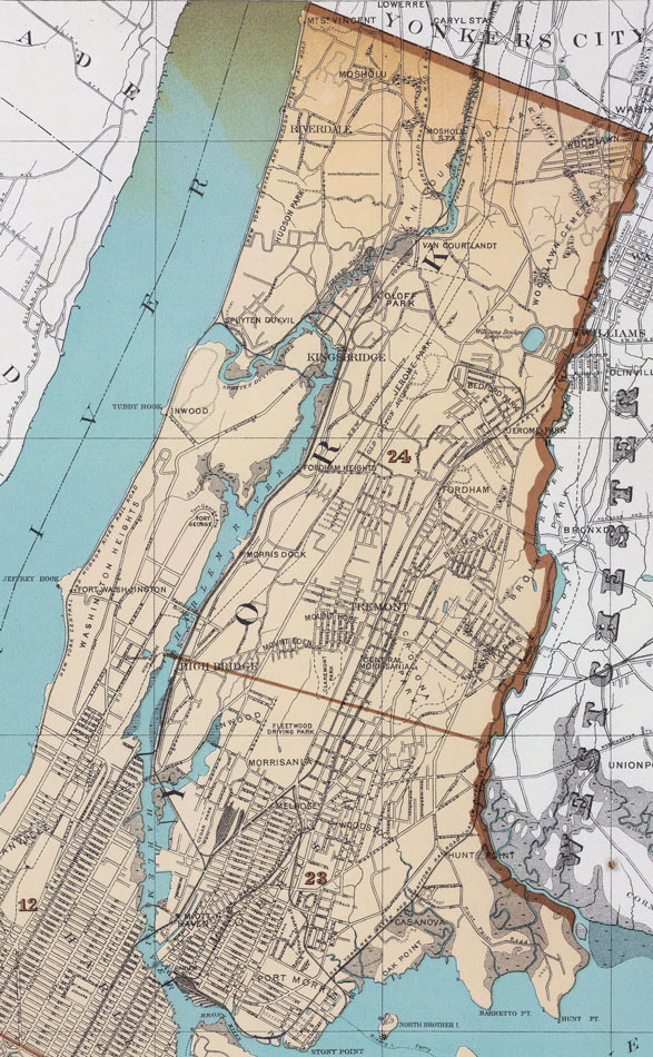
An enlarged view of the north section of New York County as it appeared in 1895. Most of this section was separated from New York County in 1914 to create Bronx County. See the additional map below.

An enlarged view of the south section of New York County as it appeared in 1895. This is most of present day New York County and consists entirely of the City of Manhattan.
View additional New York Maps here: New York County Maps
County maps from other states can be viewed here: State County Maps
Use the links at the top right of this page to search or browse thousands of family biographies.