My Genealogy Hound
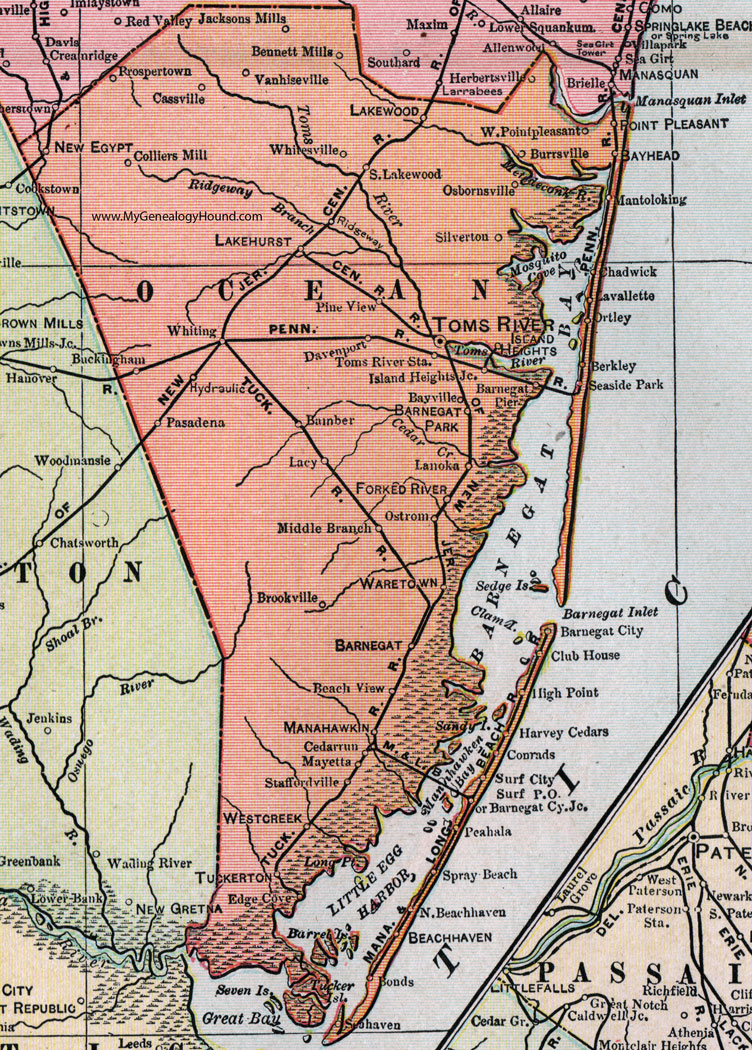
Ocean County, New Jersey, 1905 Map

Locations shown include: Bamber, Barnegat, Barnegat City, Barnegat City Junction, Barnegat Park, Barnegat Pier, Bayhead (Bay Head), Bayville, Beachhaven (Beach Haven), Beach View, Bennett Mills, Berkley, Bonds, Brookville, Buckingham, Burrsville, Cassville, Cedarrun (Cedar Run), Chadwick, Club House, Colliers Mill, Conrads, Davenport, Edge Cove, Forked River, Harvey Cedars, Herbertsville, High Point, Hydraulic, Island Heights, Island Heights Junction, Jackson Mills, Lacy, Lakehurst, Lakewood, Lanoka, Lavallette, Manahawkin, Mantoloking, Mayetta, Middle Branch, New Egypt, North Beachhaven (North Beach Haven), Ortley, Osbornville, Ostrom, Pasadena, Peahala, Pine View, Point Pleasant, Prospertown, Ridgeway, Seahaven, Seaside Park, Silverton, South Lakewood, Staffordville, Surf City, Surf City P O, Toms River, Toms River Station, Tuckerton, Vanhiseville (Van Hiseville), Waretown, Westcreek (West Creek), West Pointpleasant (West Point Pleasant), Whitesville, Whiting.
This Ocean County map is a portion of a 1905 New Jersey map by George F. Cram.
View additional New Jersey Maps here: New Jersey County Maps
County maps from other states can be viewed here: State County Maps
Use the links at the top right of this page to search or browse thousands of family biographies.