My Genealogy Hound
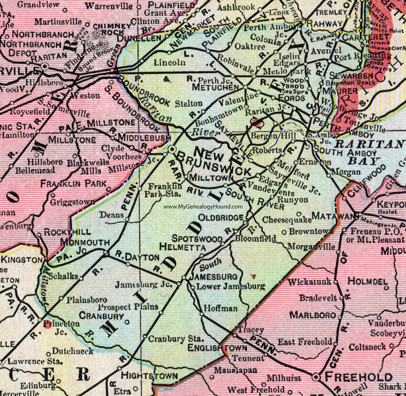
Middlesex County, New Jersey, 1905 Map

Locations shown include: Avenel, Bergen Hill, Bloomfield, Bonhamtown, Boynton Beach, Browntown, Carteret, Cheesequake, Colonia, Cranbury, Cranbury Station, Dayton, Deans, Dunellenn Edgars, Ernston, Fords, Franklin Park Station, Helmetta, Hoffman, Iselin, Jamesburg, Jamesburg Junction, Lincoln, Lower Jamesburg, Maurer, Melford, Menlo Park, Metuchen, Milltown, Monmouth Junction, Morgan, New Brunswick, Newmarket (New Market), Oaktree (Oak Tree), Oldbridge (Old Bridge), Perth Amboy, Perth Amboy Junction, Perth Junction, Plainsboro, Port Reading, Prospect Plains, Raritan Junction, Roberts, Robinvale, Runyon, Sayreville, Sayreville Junction, Schalks, Sea Springs, Sewarren, South Amboy, South Amboy Junction, South Plainfield, South River, Spotswood, Stelton, Valentine, Vandevents, Warners, Williams & Clarks, Woodbridge, Woodbridge Junction.
This Middlesex County map is a portion of a 1905 New Jersey map by George F. Cram.
View additional New Jersey Maps here: New Jersey County Maps
County maps from other states can be viewed here: State County Maps
Use the links at the top right of this page to search or browse thousands of family biographies.