My Genealogy Hound
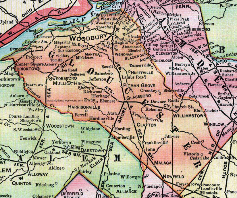
Gloucester County, New Jersey, 1905 Map

Locations shown include: Almonesson, Asbury, Aura, Barnsboro, Bassett P O, Bridgeport, Cecil, Center Square, Church Street, Clarksboro, Clayton, Clearview, Coopers, Crosskeys (Cross Keys), Downer, Elsmere, Ewan, Ferrell, Forestgrove (Forest Grove), Franklinville, Gibbstown, Glassboro, Harding, Hardingville, Harrisonville, Harrisonville Station, Heritage, Hurffville, Iona, Janvier, Jefferson, Lambs Road, Leonards, Magazine, Malaga, Mantua, Mickleton, Mount Royal, Mullica Hill, Newfield, North Woodbury, Ogden, Paradise, Parkville, Paulsboro, Pitman Grove, Prospect, Radix, Repaupo, Repaupo Station, Richwood, Robanna, Rulon Road, Sewell, Sherwin, South Westville, Swedesboro, Tatem, Temperanceville, Thorofare, Tomlin, Turnersville, Victoria, Wenonah, Westville, Williamstown, Wolfert, Woodbury, Woodbury Heights.
This Gloucester County map is a portion of a 1905 New Jersey map by George F. Cram.
View additional New Jersey Maps here: New Jersey County Maps
County maps from other states can be viewed here: State County Maps
Use the links at the top right of this page to search or browse thousands of family biographies.