My Genealogy Hound
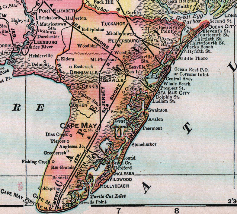
Cape May County, New Jersey, 1905 Map

Locations shown include: Anglesea, Anglesea Junction, Avalon, Beech Cr., Belleplaine, Bennett, Burleigh, Cape May, Cape May Court House, Cape May Point, Clermont, Coldspring, Corsons Inlet, Crook Horn, Dennisville, Dias Creek, Eastcreek, Eldora, Erma, Fishing Creek, Goshen, Goshen Station, Grassy Sound, Greencreek (Green Creek), Hereford, Hollybeach (Holly Beach), Marmora, Middle Thoro, Middletown, Mount Pleasant, Ocean City, Ocean Rest P O, Oceanview (Ocean View), Palerma, Pecks Beach, Peermont, Petersburg, Pierces, Reesleys Point, Rio Grande, Sea Isle, Sea Isle City, Sea Isle Junction, Seaville, Seaville Station, Sewells Point, South Dennis, South Seaville, Stoneharbor (Stone Harbor), Swain, Swainton, Tuckahoe, Whale Beach, Wildwood, Woodbine, Woodbine Station.
This Cape May County map is a portion of a 1905 New Jersey map by George F. Cram.
View additional New Jersey Maps here: New Jersey County Maps
County maps from other states can be viewed here: State County Maps
Use the links at the top right of this page to search or browse thousands of family biographies.