My Genealogy Hound
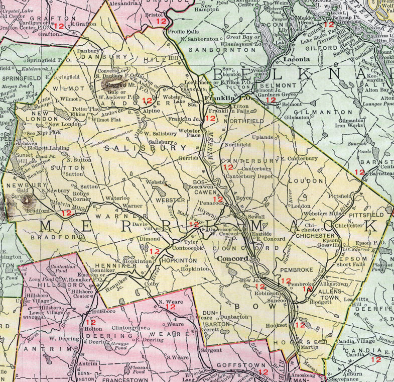
Merrimack County, New Hampshire Map, 1912

Locations shown include: Allenstown, Alpine, Andover, Blodgett, Blodgett Landing, Boscawen, Bow, Bow Junction, Boyce, Bradford, Canterbury, Canterbury Depot, Chichester, Colby, Concord, Contoocook, Converse, Danbury, Hill, Davisville, Dimond, Dunbarton, East Andover, East Canterbury, East Concord, Eastside, Edgemont, Elkins, Emerson, Epsom, Franklin, Franklin Falls, Franklin Junction, Gale, Garrison, Gerrish, Gossville, Halcyon, Henniker, Henniker Junction, Hookset (Hooksett), Hopkinton, Lake Sunapee, Loudon, Martin, Mast Yard, Melvin Mills, Mount Sunapee, Newbury, New London, North Chichester, Northfield, North Sutton, Pembroke, Penacock, Pittsfield, Potter Place, Riverhill, Robinson, Robys Corner, Salibury, Sewall, Short Falls, Soo Nipi Park, South Danbury, South Newbury, South Sutton, Station, Suncook, Sutton, Tilton, Tyler, Uplands, Warner, Waterloo, Webster, Webster Lake, Webster Place, Websters Mills, West Andover, West Concord, West Henniker, West Hopkinton, West Salisbury, Wilmot, Wilmot Flat.
This Merrimack County map is a portion of a 1912 New Hampshire map by Rand McNally.
View additional New Hampshire maps here: New Hampshire County Maps
County maps from other states can be viewed here: State County Maps
Use the links at the top right of this page to search or browse thousands of family biographies.