My Genealogy Hound
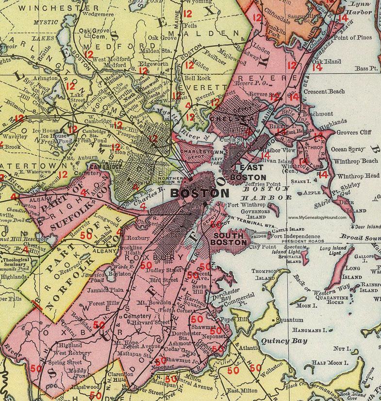
Suffolk County, Massachusetts 1903 Map

Locations shown include: Allston * Ashmont * Beachmont * Boston * Boylston * Brighton * Cedar Grove * Central * Charlestown * Chelsea * Chickering * City Point * Crescent Beach * Dorchester Station * East Boston * Fields Corner * Forest Hills * Fort Independence * Fort Warren * Fort Winthrop * Granite Bridge * Grovers Cliff * Harbor View * Harrison Square * Heath * Highland * Highlands * Jamaica Plain * Jeffries Point * Linden * Mattapan Station * Mount Bowdoin * Mount Hope * Neponset * Oak Island * Ocean Spray * Orient Heights * Point of Pines * Point Shirley * Revere * Revere P O * Revere Station * Roslindale * Roxbury * Savin Hill * Shawmut * Shawmut Junction * South Boston * West Roxbury * Winthrop * Winthrop Beach * Winthrop Head *
This Suffolk County map is a portion of a 1903 Massachusetts map by Rand McNally.
View additional Massachusetts Maps here: Massachusetts County Maps
County maps from other states can be viewed here: State County Maps
Use the links at the top right of this page to search or browse thousands of family biographies.