My Genealogy Hound
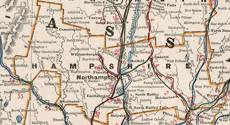
Hampshire County, Massachusetts 1901 Map

Locations shown include: Amherst * Bancroft P O * Bay State * Belchertown * Chesterfield * Cummington * Dwight * Easthampton * Enfield * Florence * Gates Siding * Goshen * Granby * Greenwich * Greenwich Village * Hadley * Hatfield * Hatfield Station * Haydenville * Huntington * Leeds * Loudville * Middlefield * Middlefield Station * Mount Tom * North Amherst * North Hadley * Northampton * North Hatfield * North Prescott * Norwich * Pansy Park * Plainfield * Prescott * Ringville * Smith's * Smith's Ferry * South Amherst * South Hadley * South Hadley Falls * Southampton * South Worthington * Swift River * Ware * West Chesterfield * West Cummington * West Farms * Westhampton * West Hatfield P O * West Pelham * West Ware * West Worthington * Williamsburgh * Worthington *
This Hampshire County map is a portion of a 1901 Massachusetts map by Cram.
View additional Massachusetts Maps here: Massachusetts County Maps
County maps from other states can be viewed here: State County Maps
Use the links at the top right of this page to search or browse thousands of family biographies.