My Genealogy Hound
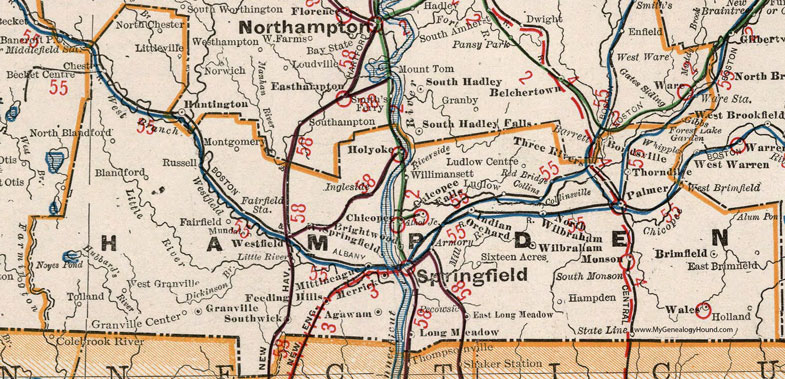
Hampden County, Massachusetts 1901 Map

Locations shown include: Agawam * Athol Junction * Armory * Blandford * Bondsville * Brightwood * Brimfield * Chester * Chicopee * Chicopee Falls * Collins * Collinsville * East Brimfield * East Long Meadow * Fairfield * Fairfield Station * Feeding Hills * Forest Lake Garden * Gibbs * Granville * Granville Center * Hampden * Holland * Holyoke * Indian Orchard * Ingleside * Little River * Littleville * Long Meadow * Ludlow * Ludlow Centre * Merrick * Mittineague * Monson * Montgomery * Mundale * North Blandford * North Chester * North Wilbraham * Palmer * Pecowsic * Red Bridge * Riverside * Russell * Sixteen Acres * South Monson * Southwick * Springfield * State Line * Thorndike * Three Rivers * Tolland * Wales * West Brimfield * Westfield * West Granville * West Springfield * Whipple * Wilbraham * Willimansett *
This Hampden County map is a portion of a 1901 Massachusetts map by Cram.
View additional Massachusetts Maps here: Massachusetts County Maps
County maps from other states can be viewed here: State County Maps
Use the links at the top right of this page to search or browse thousands of family biographies.