My Genealogy Hound
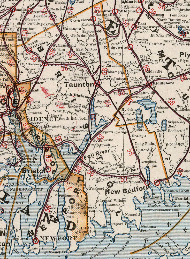
Bristol County, Massachusetts 1901 Map

Locations shown include: Acushnet * Adamsdale * Attleboro * Attleboro Falls * Barrowsville * Bearcroft * Berkley * Berkley Station * Bowenville * Brayley's * Brayton * Brittania P O * Central Village * Chartley * Clifford * Crystal Springs Station * Dartmouth * Dighton * Dodgeville * East Freetown * East Mansfield * East Norton * Easton * Eastondale * East Taunton * Fairhaven * Fall River * Flint Village * Freetown * Harris * Hebronville * Hemlock * Hicksville (Hixville) * Hortonville * Judson * Long Plain * Mansfield * Mount Pleasant * New Bedford * Nonquitt * North Attleboro * North Dartmouth * North Dartmouth Station * North Dighton * North Easton * North Raynham P O * North Rehoboth * North Swansea * North Westport * Norton * Norton Furnace * Pleasantview * Pottersville * Raynham * Raynham Station * Rehoboth * Scaddings Pond * Seekonk * Segreganset * Shawmut * Somerset * South Attleboro * South Dartmouth * South Easton * South Rehoboth * South Westport * Steep Brook * Swansea * Swansea Centre * Taunton * Weir Junction * West Dighton * West Mansfield * Westport * Westport Factory * Westport Point * Whittenton *
This Bristol County map is a portion of a 1901 Massachusetts map by Cram.
View additional Massachusetts Maps here: Massachusetts County Maps
County maps from other states can be viewed here: State County Maps
Use the links at the top right of this page to search or browse thousands of family biographies.