My Genealogy Hound
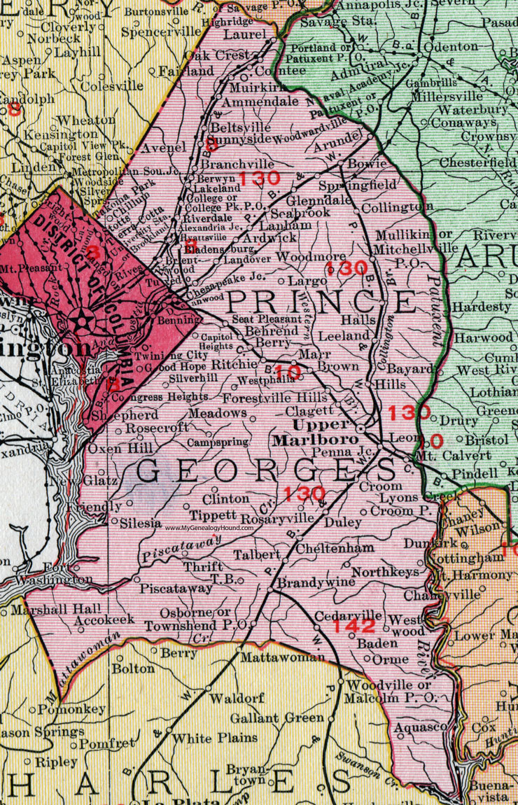
Prince George’s County, Maryland 1911 Map

Locations shown include: Accokeek * Aquasco * Alexandria Junction * Ammendale * Ardwick * Arundel * Baden * Behrend * Beltsville * Berry * Berwyn * Bladensburg * Bowie * Branchville * Brandywine * Brentwood * Brown * Campspring (Camp Spring) * Capitol Heights * Cedarville * Cheltenham * Clagett * Clinton * College * College Park P O * Collington * Contee * Croom * Croom P O * Duley * Forestville Hills * Fort Washington * Friendly * Glatz * Glenndale (Glenn Dale) * Halls * Hills * Hyattsville * Lakeland * Landover * Lanham * Largo * Laurel * Leeland * Lyons * Marr * Meadows * Mitchellville P O * Mount Calvert * Muirkirk * Mullikin * Northkeys (North Keys) * Oak Crest * Orme * Osborne * Oxen Hill (Oxon Hill) * Penna Junction * Piscataway * Ritchie * Riverdale * Rosaryville * Rosecroft * Seabrook * Seat Pleasant * Silesia * Silverhill (Silver Hill) * Springfield * Sunnyside * Talbert * T B * Thrift * Tippett * Townshend P O * Tuxedo * Upper Marlboro * Westphalia * Westwood * Woodmore *
This Prince George’s County map is a portion of a 1911 Maryland map by Rand McNally.
View additional Maryland Maps here: Maryland County Maps
County maps from other states can be viewed here: State County Maps
Use the links at the top right of this page to search or browse thousands of family biographies.