My Genealogy Hound
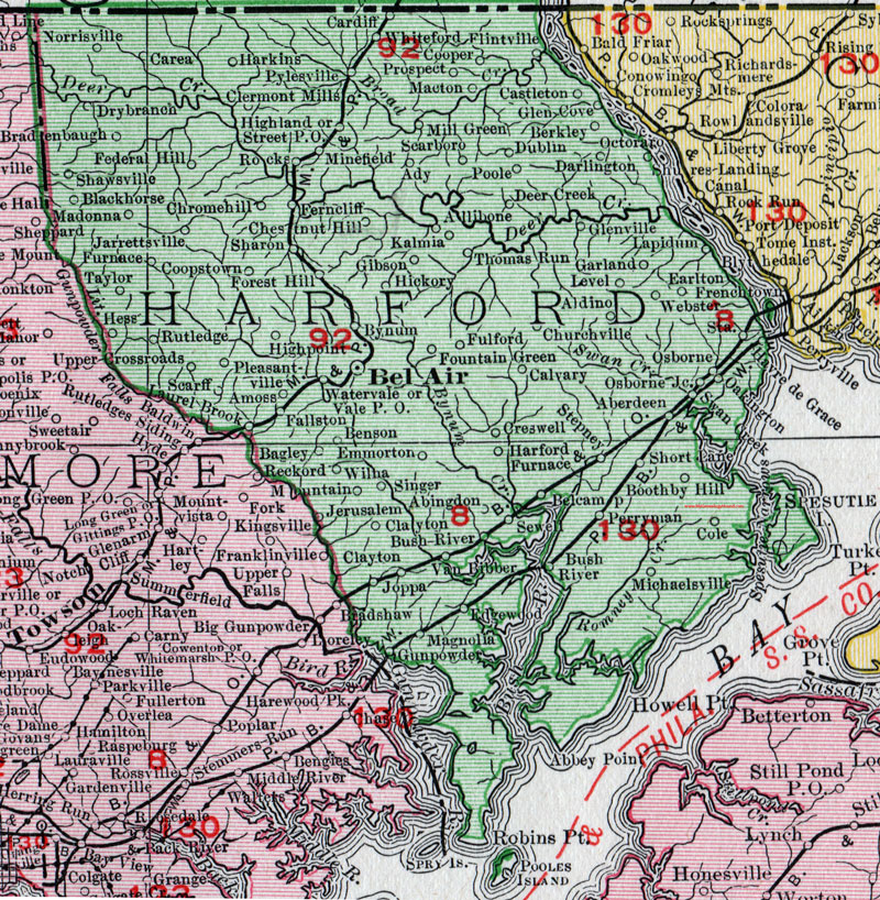
Harford County, Maryland 1911 Map

Locations shown include: Aberdeen * Abingdon * Ady * Aldino * Allibone * Amoss * Bagley * Bel Air * Belcamp * Benson * Berkley * Blackhorse * Boothby Hill * Bradenbaugh * Bush River * Bynum * Calvary * Cardiff * Carea * Castleton * Chestnut Hill * Chromehill (Chrome Hill) * Clayton * Clermont Mills * Cole * Cooper * Coopstown * Creswell * Darlington * Deer Creek * Drybranch * Dublin * Earlton * Edgewood * Emmorton * Fallston * Federal Hill * Ferncliff * Flintville * Forest Hill * Fountain Green * Fulford * Furnace * Garland * Gibson * Glen Cove * Glenville * Gunpowder * Harford Furnace * Harkins * Havre de Grace * Hess * Hickory * Highland * Highpoint (High Point) * Kalmia * Jarrettsville * Jerusalem * Joppa (Joppatowne) * Lapidum * Laurel Brook * Level * Macton * Madonna * Magnolia * Michaelsville * Mill Green * Minefield * Mountain * Norrisville * Oakington * Osborne * Osborne Junction * Perryman * Pleasantville * Poole * Prospect * Pylesville * Reckford * Rocks * Rutledge * Scarboro * Scarff * Sewell * Sharon * Shawsville * Short Lane * Singer * Stepney * Street P O * Swan Creek * Taylor * Thomas Run * Upper Crossroads * Vale P O * Van Bibber * Watervale * Webster * Whiteford * Wilna *
This Harford County map is a portion of a 1911 Maryland map by Rand McNally.
View additional Maryland Maps here: Maryland County Maps
County maps from other states can be viewed here: State County Maps
Use the links at the top right of this page to search or browse thousands of family biographies.