My Genealogy Hound
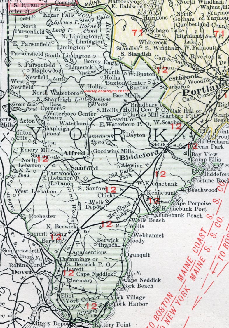
York County, Maine, 1912 Map

Locations shown include: Acton, Agamenticus, Alewive, Alfred, Bar Mills, Bay View, Beachwood, Berwick, Berwick Branch, Biddeford, Biddeford Pool, Bonny Eagle, Bradbury, Buxton, Buxton Center, Camp Ellis, Cape Neddick, Cape Porpoise, Chicks, Clarks Mill, Cummings, Dayton, Eastwood, East Lebanon P. O., East Limington, East Parsonfield, East Waterboro P. O., Eliot, Emery Mills, Fortune Rock, Goodwins Mills, Hollis Center P. O., Jewett, Kennebunk, Kennebunk Beach, Kennebunk Port, Kezar Falls, Kittery, Kittery Depot, Kittery Point, Lebanon, Limerick, Limington, Maplewood, Merriland Ridge, Moody, Newfield, North Berwick, North Hollis, North Lebanon, North Limington, North Parsonfield, North Shapleigh, North Waterloo, Ocean Park, Ogunquit, Old Falls Park, Old Orchard, Parsonfield, Rosemary, Ross Corners, Sanford, Shapleigh, South Acton, South Berwick P. O., South Eliot, South Hollis, South Limington, South Parsonfield, South Sanford, Springvale, Waterboro, Waterboro Center, Webhannet, Wells, Wells Beach, Wells Depot, Westcott, West Buxton, West Hollis, West Lebanon, West Kennebunk, West Newfield, York Corner, York Harbor, York Village.
This York County map is a portion of a 1912 map of Maine by Rand McNally.
View additional Maine Maps here: Maine County Maps
County maps from other states can be viewed here: State County Maps
Use the links at the top right of this page to search or browse thousands of family biographies.