My Genealogy Hound
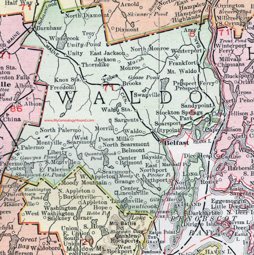
Waldo County, Maine, 1912 Map

Locations shown include: Arey, Bayside, Belfast, Belmont, Brooks, Cape Jellison, Cape Jellison Junction, Center Belmont, Center Lincolnville, Citypoint, East Jackson, East Northport, East Palermo, Forbes, Frankfort, Freedom, Grange, Jackson, Knox Station, Islesport, Liberty, Lincolnville, Marshall Point, Monroe, Montville, Moody Mountain, Morrill, Mt. Waldo, Northport, North Islesboro, North Monroe, North Palermo, North Searsmont, Palermo, Palermo Center, Park, Poors Mills, Prospect, Prospect Ferry, Sargents, Searsmont, Searsport, Sandypoint, South Montville, Stockton Springs, Swanville, Thorndike, Troy, Unity, Waldo, Waldo Station, West Searsmont, Winnecook, Winterport.
This Waldo County map is a portion of a 1912 map of Maine by Rand McNally.
View additional Maine Maps here: Maine County Maps
County maps from other states can be viewed here: State County Maps
Use the links at the top right of this page to search or browse thousands of family biographies.