My Genealogy Hound
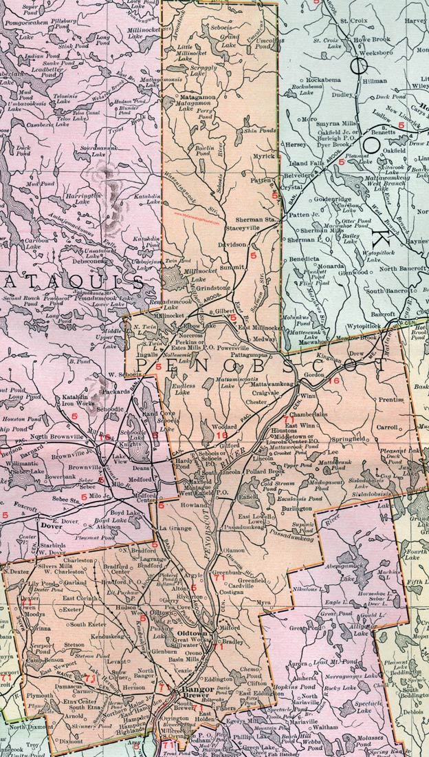
Penobscot County, Maine, 1912 Map

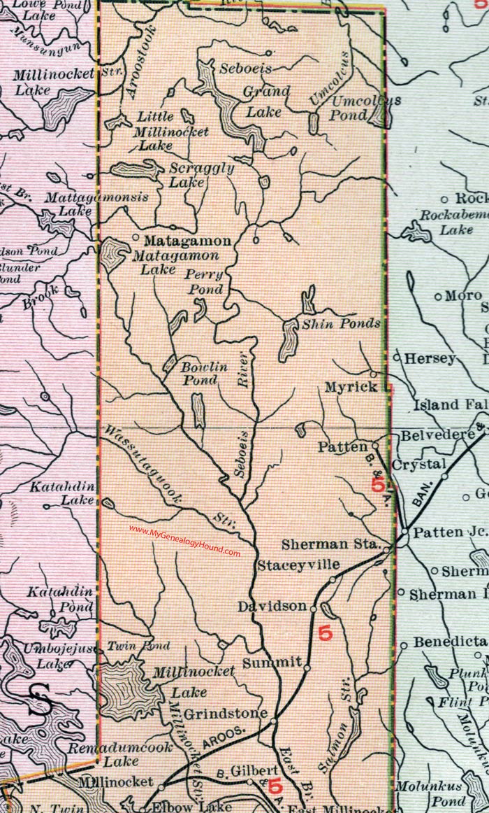
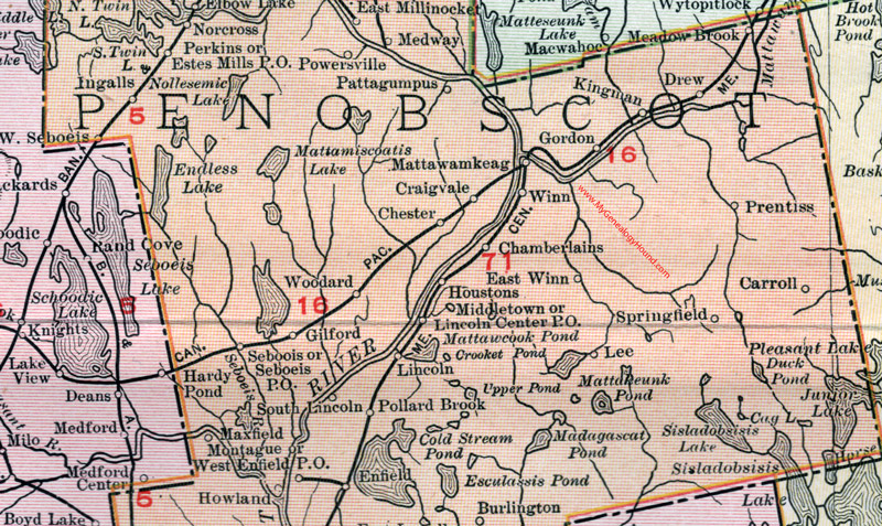
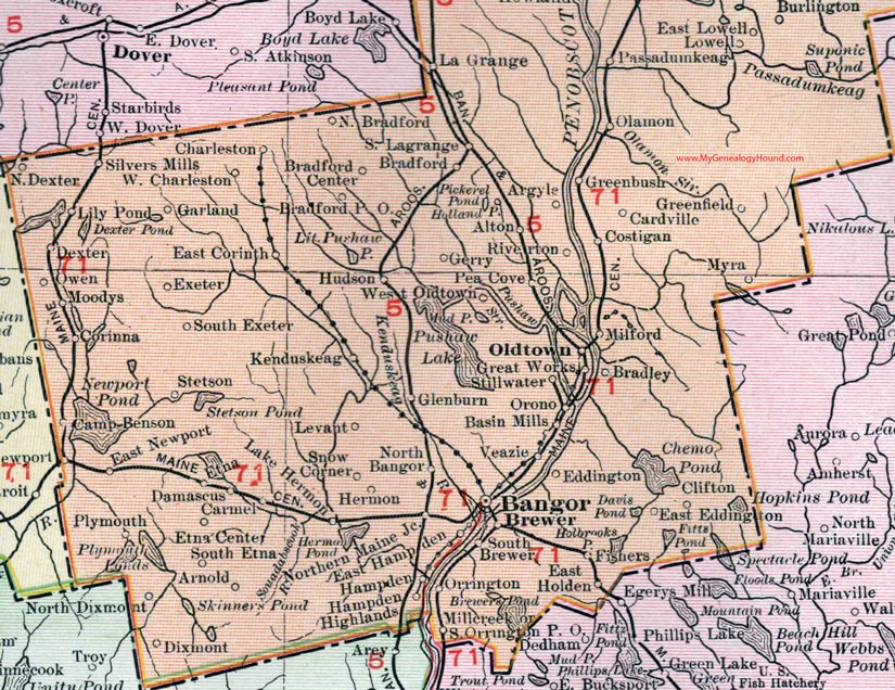
(See enlarged portions of this map below.)
Locations shown include: Alton, Argyle, Arnold, Bangor, Basin Mills, Bradford, Bradford Center, Bradford P. O., Bradley, Brewer, Burlington, Camp Benson, Cardville, Carmel, Carroll, Chamberlains, Charleston, Chester, Clifton, Corinna, Costigan, Craigville, Damascus, Davidson, Dexter, Dixmont, Drew, East Corinth, East Hampden, East Holden, East Lowell, East Millinocket, East Newport, East Winn, Eddington, Elbow Lake, Enfield, Estes Mills P. O., Etna, Etna Center, Exeter, Fishers, Garland, Gerry, Gilbert, Gilford, Glenburn, Gordon, Great Works, Greenfield, Grindstone, Hampden, Hampden Highlands, Hermon, Houstons, Howland, Hudson, Ingalls, Kenduskeag, Kingman, La Grange, Lake Hermon, Lee, Levant, Lily Pond, Lincoln, Lincoln Center P. O., Lowell, Matagamon, Mattawamkeag, Maxfield, Meadow Brook, Medway, Middletown, Milford, Millcreek, Millinocket, Montague, Moodys, Myra, Myrick, Norcross, North Bangor, North Bradford, North Dexter, North Dixmont, Northern Maine Junction, Olamon, Oldtown, Orono, Orrington, Owen, Passadumkeag, Pattagumpus, Patten, Pea Cove, Perkins, Plymouth, Pollard Brook, Powersville, Prentiss, Riverton, Seboeis P. O., Seboois, Sherman Station, Silvers Mills, Snow Corner, South Brewer, South Etna, South Exeter, South Lagrange, South Lincoln, South Orrington P. O., Springfield, Staceyville, Stetson, Stillwater, Summit, West Enfield P. O., West Seboeis, Veazie, West Charleston, West Oldtown, Winn, Woodard.
This Penobscot County map is a portion of a 1912 map of Maine by Rand McNally.

Map of the northern portion of Penobscot County, Maine.

Map of the central portion of Penobscot County, Maine.

Map of the southern portion of Penobscot County, Maine.
View additional Maine Maps here: Maine County Maps
County maps from other states can be viewed here: State County Maps
Use the links at the top right of this page to search or browse thousands of family biographies.