My Genealogy Hound
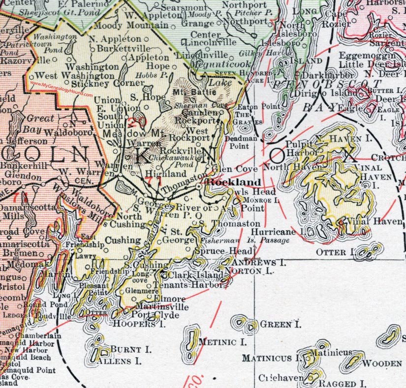
Knox County, Maine, 1912 Map

Locations shown include: Appleton, Ash Point, Burkettville, Camden, Clark Island, Criehaven, Cushing, East Friendship, East Union, Elmore, Friendship, Georges River, Glen Cove, Glenmere, Highland, Hope, Lawry, Longcove, Martin, Martinsville, Matinicus, North Appleton, North Cushing, North Haven, North Warren, Owls Head, Pleasant Point, Port Clyde, Pulpit Harbor, Razorville, Rockland, Rockport, Rockville, South Cushing, South Hope, South Thomaston, South Union, South Warren P. O., Spruce Head, St. George, Stickney Corner, Tenants Harbor, Thomaston, Union, Vinalhaven (Vinal Haven), Warren, Washington, West Appleton, West Rockport, West Warren, West Washington.
This Knox County map is a portion of a 1912 map of Maine by Rand McNally.
View additional Maine Maps here: Maine County Maps
County maps from other states can be viewed here: State County Maps
Use the links at the top right of this page to search or browse thousands of family biographies.