My Genealogy Hound
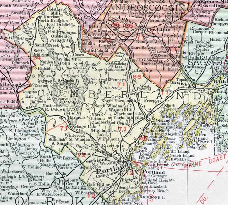
Cumberland County, Maine, 1912 Map

(See enlarged portions of this map below.)
Locations shown include: Baldwin, Bolster Mills, Bowery Beach, Bridgton, Brunswick, Cape Cottage, Cape Elizabeth, Casco, Cash Corner, Convene, Cooks, Cumberland Center, Cumberland Mills, Cundys Harbor, Deering, Deeting Junction, Douglas Hill, Dry Mills, East Baldwin P. O., East Gray, East Otisfield, East Sebago, Falmouth, Freeport, Gorham, Gray, Hardin, Harmons, Harpswell, Harrison, Highland Lake, Hillside, Intervale, Mariner, Mattocks, Naples, New Gloucester, North Baldwin, North Bridgton, North Gorham, North Raymond, North Sebago, North Windham, North Woodfords, North Yarmouth, Oak Hill, Otisfield, Penneys, Pine Point, Pond Cove, Portland, Prouts Neck, Raymond, Rigby, Riverton, Sabbathday Lake, Sandy Creek, Scarboro, Scarboro Beach, Scarboro P. O., Sebago, Sebago Lake, Songo Lake, South Bridgton, South Casco, South Freeport, South Harpswell, South Naples, South Portland, South Portland Heights, South Standish, South Windham, Standish, Topsham, Trefethen, Walnut Hill, Webbs Mills, Westbrook, West Falmouth, West Pownal, West Scarboro, White Rock, Windham, Yarmouth, Yarmouth Junction, Yarmouthville P. O.
This Cumberland County map is a portion of a 1912 map of Maine by Rand McNally.

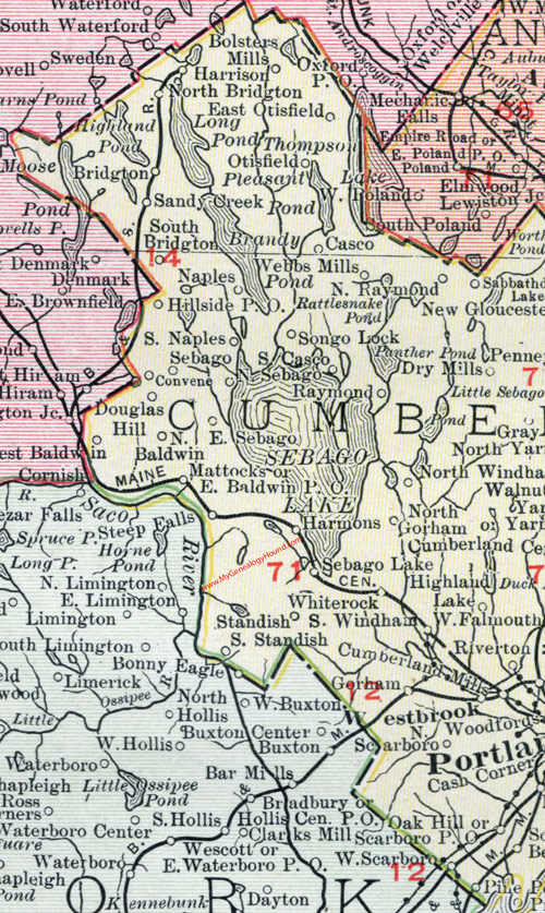
Map of the western portion of Cumberland County, Maine.

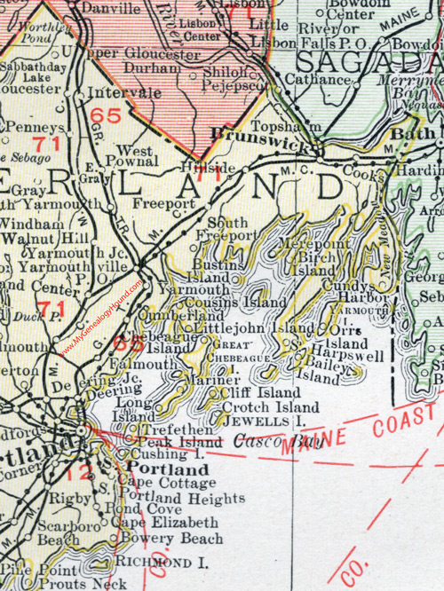
Map of the eastern portion of Cumberland County, Maine.
View additional Maine Maps here: Maine County Maps
County maps from other states can be viewed here: State County Maps
Use the links at the top right of this page to search or browse thousands of family biographies.